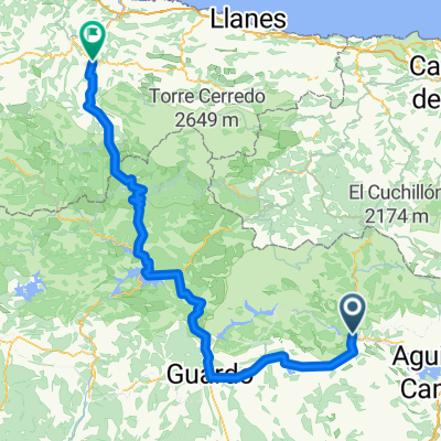
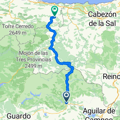
Stage 2 - Ruta del Boedo Ojeda
A cycling route starting in Cervera de Pisuerga, Castille and Le贸n, Spain.
Overview
About this route
- -:--
- Duration
- 94.5 km
- Distance
- 952 m
- Ascent
- 955 m
- Descent
- ---
- Avg. speed
- 1,156 m
- Avg. speed
Route quality
Waytypes & surfaces along the route
Waytypes
Road
62.7 km
(66 %)
Busy road
24.4 km
(26 %)
Surfaces
Paved
78.8 km
(83 %)
Unpaved
0.2 km
(<1 %)
Asphalt
78.8 km
(83 %)
Ground
0.1 km
(<1 %)
Continue with Bikemap
Use, edit, or download this cycling route
You would like to ride Stage 2 - Ruta del Boedo Ojeda or customize it for your own trip? Here is what you can do with this Bikemap route:
Free features
- Save this route as favorite or in collections
- Copy & plan your own version of this route
- Sync your route with Garmin or Wahoo
Premium features
Free trial for 3 days, or one-time payment. More about Bikemap Premium.
- Navigate this route on iOS & Android
- Export a GPX / KML file of this route
- Create your custom printout (try it for free)
- Download this route for offline navigation
Discover more Premium features.
Get Bikemap PremiumFrom our community
Other popular routes starting in Cervera de Pisuerga
- cervera-vidrieros-puertos de riofrio-ledantes
- Distance
- 56.6 km
- Ascent
- 1,059 m
- Descent
- 1,262 m
- Location
- Cervera de Pisuerga, Castille and Le贸n, Spain
- Fuente Deshondonada
- Distance
- 31.2 km
- Ascent
- 320 m
- Descent
- 320 m
- Location
- Cervera de Pisuerga, Castille and Le贸n, Spain
- de los Tres Valles
- Distance
- 27.9 km
- Ascent
- 225 m
- Descent
- 218 m
- Location
- Cervera de Pisuerga, Castille and Le贸n, Spain
- Lechetronica 2013
- Distance
- 163.7 km
- Ascent
- 0 m
- Descent
- 0 m
- Location
- Cervera de Pisuerga, Castille and Le贸n, Spain
- Despoblado de Frontada
- Distance
- 23 km
- Ascent
- 132 m
- Descent
- 169 m
- Location
- Cervera de Pisuerga, Castille and Le贸n, Spain
- Valsadornin - EL GOLOBAR - Aguilar de Campoo - Valsadornin
- Distance
- 108.6 km
- Ascent
- 1,828 m
- Descent
- 1,828 m
- Location
- Cervera de Pisuerga, Castille and Le贸n, Spain
- Ruta de los Pantanos
- Distance
- 97.2 km
- Ascent
- 729 m
- Descent
- 729 m
- Location
- Cervera de Pisuerga, Castille and Le贸n, Spain
- Cervera de pisuerga
- Distance
- 103.7 km
- Ascent
- 1,058 m
- Descent
- 1,062 m
- Location
- Cervera de Pisuerga, Castille and Le贸n, Spain
Open it in the app