

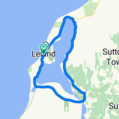
8563 E Horn Rd, Lake Leelanau to 8563 E Horn Rd, Lake Leelanau
A cycling route starting in Leland, Michigan, United States.
Overview
About this route
- 58 min
- Duration
- 20.8 km
- Distance
- 206 m
- Ascent
- 209 m
- Descent
- 21.5 km/h
- Avg. speed
- 271 m
- Max. altitude
Route quality
Waytypes & surfaces along the route
Waytypes
Quiet road
11.8 km
(57 %)
Road
4.6 km
(22 %)
Surfaces
Paved
20.8 km
(100 %)
Paved (undefined)
18.5 km
(89 %)
Asphalt
2.3 km
(11 %)
Continue with Bikemap
Use, edit, or download this cycling route
You would like to ride 8563 E Horn Rd, Lake Leelanau to 8563 E Horn Rd, Lake Leelanau or customize it for your own trip? Here is what you can do with this Bikemap route:
Free features
- Save this route as favorite or in collections
- Copy & plan your own version of this route
- Sync your route with Garmin or Wahoo
Premium features
Free trial for 3 days, or one-time payment. More about Bikemap Premium.
- Navigate this route on iOS & Android
- Export a GPX / KML file of this route
- Create your custom printout (try it for free)
- Download this route for offline navigation
Discover more Premium features.
Get Bikemap PremiumFrom our community
Other popular routes starting in Leland
 First St, Leland to First St, Leland
- Distance
- 23.5 km
- Ascent
- 88 m
- Descent
- 85 m
- Location
- Leland, Michigan, United States
 Leelanau Trail, Suttons Bay to Leelanau Trail, Suttons Bay
- Distance
- 7.6 km
- Ascent
- 83 m
- Descent
- 36 m
- Location
- Leland, Michigan, United States
 Shop to Trail Head
- Distance
- 1 km
- Ascent
- 9 m
- Descent
- 8 m
- Location
- Leland, Michigan, United States
 Leelanau Trail, Suttons Bay to 658 S West-Bay Shore Dr, Suttons Bay
- Distance
- 0.5 km
- Ascent
- 0 m
- Descent
- 0 m
- Location
- Leland, Michigan, United States
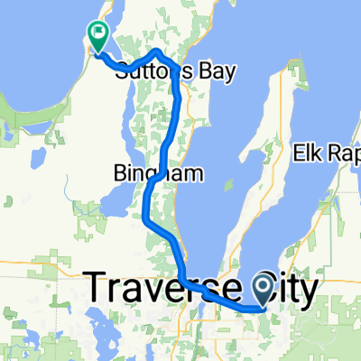 Route 35 (Michigan): Leland to Traverse City
- Distance
- 47.1 km
- Ascent
- 279 m
- Descent
- 254 m
- Location
- Leland, Michigan, United States
 Northport 14.7
- Distance
- 23.6 km
- Ascent
- 278 m
- Descent
- 276 m
- Location
- Leland, Michigan, United States
 COWS WRANGLER - LAKE LEELANAU
- Distance
- 59.1 km
- Ascent
- 255 m
- Descent
- 254 m
- Location
- Leland, Michigan, United States
 Route from Lake Leelanau
- Distance
- 6.3 km
- Ascent
- 55 m
- Descent
- 76 m
- Location
- Leland, Michigan, United States
Open it in the app