

Alpine Gravel - Lago di Celentino
A cycling route starting in Ossana, Trentino-Alto Adige, Italy.
Overview
About this route
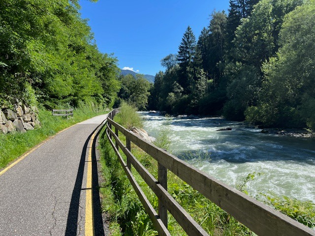
First a steep ascent, then an excellent climb on a well-maintained forest road to Malga Campo (Strudel!!!). To get to Lake Celentino technical flat section on forest trail with possible portage. Breathtaking Lago Celentino viewpoint and then technical trail in beautiful alpine surroundings to the hut. From here onwards rough or very rough dirt road downhill with considerable gradients. Ascent from Malga Stabli on an excellent forest road to a private alpine hut. From there, descend first on rough forest road, then very smooth and fast to reach the tarmac road. Once at the bottom of the valley, continue along the Val di Sole cycle path to Ossana.
Water supplies possible along the entire route, Malga Campo and Malga Satabli with gastronomic offerings.
We recommend a minimum tyre width of 45 mm, tubeless.
- -:--
- Duration
- 41.5 km
- Distance
- 1,656 m
- Ascent
- 1,645 m
- Descent
- ---
- Avg. speed
- 2,136 m
- Max. altitude

Route photos


Route quality
Waytypes & surfaces along the route
Waytypes
Track
21.1 km
(51 %)
Path
7.9 km
(19 %)
Surfaces
Paved
9.9 km
(24 %)
Unpaved
21.6 km
(52 %)
Asphalt
9.5 km
(23 %)
Loose gravel
7.5 km
(18 %)
Continue with Bikemap
Use, edit, or download this cycling route
You would like to ride Alpine Gravel - Lago di Celentino or customize it for your own trip? Here is what you can do with this Bikemap route:
Free features
- Save this route as favorite or in collections
- Copy & plan your own version of this route
- Sync your route with Garmin or Wahoo
Premium features
Free trial for 3 days, or one-time payment. More about Bikemap Premium.
- Navigate this route on iOS & Android
- Export a GPX / KML file of this route
- Create your custom printout (try it for free)
- Download this route for offline navigation
Discover more Premium features.
Get Bikemap PremiumFrom our community
Other popular routes starting in Ossana
 Val di Sole Ossana - Caldes A-R
- Distance
- 44.7 km
- Ascent
- 402 m
- Descent
- 401 m
- Location
- Ossana, Trentino-Alto Adige, Italy
 Ossana- Caldes a-r
- Distance
- 43.4 km
- Ascent
- 382 m
- Descent
- 361 m
- Location
- Ossana, Trentino-Alto Adige, Italy
 Val di Sole Ossana - Caldes
- Distance
- 41.7 km
- Ascent
- 385 m
- Descent
- 389 m
- Location
- Ossana, Trentino-Alto Adige, Italy
 Val di Sole - Ossana Caldes
- Distance
- 42.8 km
- Ascent
- 387 m
- Descent
- 388 m
- Location
- Ossana, Trentino-Alto Adige, Italy
 Abzweig Osanna-Begflanke-Merilleva-Madonna
- Distance
- 39.5 km
- Ascent
- 2,434 m
- Descent
- 1,875 m
- Location
- Ossana, Trentino-Alto Adige, Italy
 Alpencross 2010 | Etappe 7
- Distance
- 67.3 km
- Ascent
- 2,594 m
- Descent
- 3,001 m
- Location
- Ossana, Trentino-Alto Adige, Italy
 Dag 3
Dag 3- Distance
- 70.5 km
- Ascent
- 2,007 m
- Descent
- 2,330 m
- Location
- Ossana, Trentino-Alto Adige, Italy
 TOUR DEL MONTOZZO
- Distance
- 59.6 km
- Ascent
- 2,005 m
- Descent
- 2,004 m
- Location
- Ossana, Trentino-Alto Adige, Italy
Open it in the app