

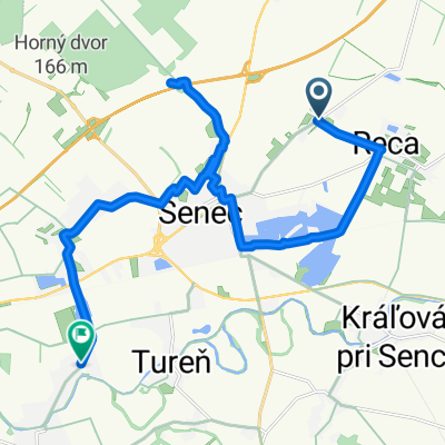
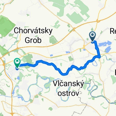
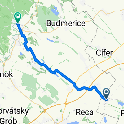
Budmerice-Bratislava
A cycling route starting in Senec, Bratislava Region, Slovakia.
Overview
About this route
- -:--
- Duration
- 57.7 km
- Distance
- 423 m
- Ascent
- 443 m
- Descent
- ---
- Avg. speed
- 344 m
- Max. altitude

Route quality
Waytypes & surfaces along the route
Waytypes
Road
15 km
(26 %)
Quiet road
15 km
(26 %)
Surfaces
Paved
41.6 km
(72 %)
Unpaved
5.2 km
(9 %)
Asphalt
41.6 km
(72 %)
Gravel
4 km
(7 %)
Continue with Bikemap
Use, edit, or download this cycling route
You would like to ride Budmerice-Bratislava or customize it for your own trip? Here is what you can do with this Bikemap route:
Free features
- Save this route as favorite or in collections
- Copy & plan your own version of this route
- Sync your route with Garmin or Wahoo
Premium features
Free trial for 3 days, or one-time payment. More about Bikemap Premium.
- Navigate this route on iOS & Android
- Export a GPX / KML file of this route
- Create your custom printout (try it for free)
- Download this route for offline navigation
Discover more Premium features.
Get Bikemap PremiumFrom our community
Other popular routes starting in Senec
 Boldog do Hlavná
- Distance
- 20.4 km
- Ascent
- 48 m
- Descent
- 45 m
- Location
- Senec, Bratislava Region, Slovakia
 Kostolná pri Dunaji do Slnečná 28, Nová Dedinka
- Distance
- 41.8 km
- Ascent
- 3 m
- Descent
- 0 m
- Location
- Senec, Bratislava Region, Slovakia
 Budmerice-Bratislava
- Distance
- 57.7 km
- Ascent
- 423 m
- Descent
- 443 m
- Location
- Senec, Bratislava Region, Slovakia
 Senec - Slnečné jazerá
- Distance
- 17 km
- Ascent
- 35 m
- Descent
- 35 m
- Location
- Senec, Bratislava Region, Slovakia
 Zonc, Zonctorony - Tureň, Zonctorony
- Distance
- 33.8 km
- Ascent
- 44 m
- Descent
- 41 m
- Location
- Senec, Bratislava Region, Slovakia
 Senec - Rybareň Svateho Petra
- Distance
- 18.1 km
- Ascent
- 5 m
- Descent
- 12 m
- Location
- Senec, Bratislava Region, Slovakia
 Lichnerova, Senec až Sadová, Ivanka pri Dunaji
- Distance
- 18.3 km
- Ascent
- 13 m
- Descent
- 8 m
- Location
- Senec, Bratislava Region, Slovakia
 Veľký Grob, Veľký Grob až Harmónia, Modra
- Distance
- 22.3 km
- Ascent
- 231 m
- Descent
- 75 m
- Location
- Senec, Bratislava Region, Slovakia
Open it in the app