

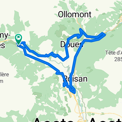
Gravel Etroubles
A cycling route starting in Etroubles, Aosta Valley, Italy.
Overview
About this route
- -:--
- Duration
- 27.2 km
- Distance
- 970 m
- Ascent
- 971 m
- Descent
- ---
- Avg. speed
- 1,781 m
- Max. altitude

Route quality
Waytypes & surfaces along the route
Waytypes
Quiet road
13.9 km
(51 %)
Track
11.7 km
(43 %)
Surfaces
Paved
9.8 km
(36 %)
Unpaved
11.7 km
(43 %)
Asphalt
9.3 km
(34 %)
Ground
9 km
(33 %)
Continue with Bikemap
Use, edit, or download this cycling route
You would like to ride Gravel Etroubles or customize it for your own trip? Here is what you can do with this Bikemap route:
Free features
- Save this route as favorite or in collections
- Copy & plan your own version of this route
- Sync your route with Garmin or Wahoo
Premium features
Free trial for 3 days, or one-time payment. More about Bikemap Premium.
- Navigate this route on iOS & Android
- Export a GPX / KML file of this route
- Create your custom printout (try it for free)
- Download this route for offline navigation
Discover more Premium features.
Get Bikemap PremiumFrom our community
Other popular routes starting in Etroubles
 Szent Bernáth Hágó
- Distance
- 37.2 km
- Ascent
- 1,186 m
- Descent
- 1,186 m
- Location
- Etroubles, Aosta Valley, Italy
 Gran San Bernardo - krótka
- Distance
- 35.4 km
- Ascent
- 1,186 m
- Descent
- 1,187 m
- Location
- Etroubles, Aosta Valley, Italy
 Valpeline depuis Etrouble
- Distance
- 68.8 km
- Ascent
- 1,617 m
- Descent
- 1,613 m
- Location
- Etroubles, Aosta Valley, Italy
 Alpi 2016: stage 1 Etroubles - Chamonix
- Distance
- 98.6 km
- Ascent
- 2,509 m
- Descent
- 2,713 m
- Location
- Etroubles, Aosta Valley, Italy
 Gravel Etroubles
- Distance
- 27.2 km
- Ascent
- 970 m
- Descent
- 971 m
- Location
- Etroubles, Aosta Valley, Italy
 Parigi 2 tappa Etroubles-Losanna
- Distance
- 131.3 km
- Ascent
- 1,412 m
- Descent
- 2,182 m
- Location
- Etroubles, Aosta Valley, Italy
 Etroubles - Lourtier
- Distance
- 56.2 km
- Ascent
- 1,909 m
- Descent
- 2,104 m
- Location
- Etroubles, Aosta Valley, Italy
 Etroubles_boucle courte Valpeline
- Distance
- 38 km
- Ascent
- 1,487 m
- Descent
- 1,487 m
- Location
- Etroubles, Aosta Valley, Italy
Open it in the app