

L4 Teil 1: Paray-le-Monial - Montceau-les-Mines; 37,2km 110hm
A cycling route starting in Paray-le-Monial, Bourgogne-Franche-Comté, France.
Overview
About this route
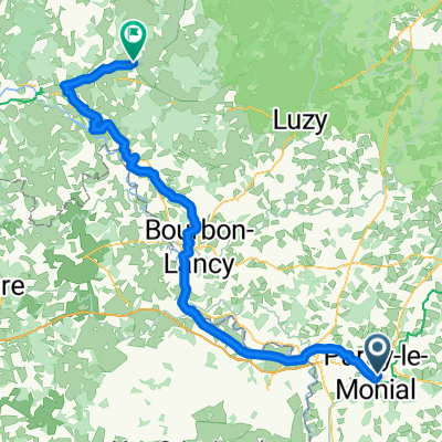
Paray-le-Monial - (EV6) - (ALT6) - La Gravoine - (EV6) - La Forge - Digoine - La Thiellay - Palinges - (ALT6) - Le Montet - Genelard - Ciry-le-Noble - Les Chavannes - Montceau-les-Mines
- -:--
- Duration
- 37.2 km
- Distance
- 156 m
- Ascent
- 105 m
- Descent
- ---
- Avg. speed
- 295 m
- Avg. speed

Route quality
Waytypes & surfaces along the route
Waytypes
Road
26.3 km
(71 %)
Quiet road
4.5 km
(12 %)
Surfaces
Paved
7.1 km
(19 %)
Asphalt
6.9 km
(19 %)
Concrete
0.1 km
(<1 %)
Route highlights
Points of interest along the route

Point of interest after 14.9 km
Chateaux de Digoine

Point of interest after 16.8 km
Pasarelles
Point of interest after 18.7 km
Strand
Accommodation after 36.2 km
Hotel du Commerce, 2 Place Henri Dureault, 71460 Joncy
Continue with Bikemap
Use, edit, or download this cycling route
You would like to ride L4 Teil 1: Paray-le-Monial - Montceau-les-Mines; 37,2km 110hm or customize it for your own trip? Here is what you can do with this Bikemap route:
Free features
- Save this route as favorite or in collections
- Copy & plan your own version of this route
- Sync your route with Garmin or Wahoo
Premium features
Free trial for 3 days, or one-time payment. More about Bikemap Premium.
- Navigate this route on iOS & Android
- Export a GPX / KML file of this route
- Create your custom printout (try it for free)
- Download this route for offline navigation
Discover more Premium features.
Get Bikemap PremiumFrom our community
Other popular routes starting in Paray-le-Monial
 L4 Teil 1: Paray-le-Monial - Montceau-les-Mines; 37,2km 110hm
- Distance
- 37.2 km
- Ascent
- 156 m
- Descent
- 105 m
- Location
- Paray-le-Monial, Bourgogne-Franche-Comté, France
 Paray-le-Monial - Commentry 126km 720Hm
- Distance
- 125.9 km
- Ascent
- 511 m
- Descent
- 403 m
- Location
- Paray-le-Monial, Bourgogne-Franche-Comté, France
 Etape 6 Paray le Monial - Cercy-La-Tour
- Distance
- 98.3 km
- Ascent
- 172 m
- Descent
- 199 m
- Location
- Paray-le-Monial, Bourgogne-Franche-Comté, France
 L3+4 nord sehr lang: Paray-le-Monial - Macon; 376km 660hm
- Distance
- 384.7 km
- Ascent
- 1,525 m
- Descent
- 1,575 m
- Location
- Paray-le-Monial, Bourgogne-Franche-Comté, France
 massif east 1
- Distance
- 473.1 km
- Ascent
- 2,609 m
- Descent
- 2,698 m
- Location
- Paray-le-Monial, Bourgogne-Franche-Comté, France
 L3+4 nord: Paray-le-Monial - Macon; 170,1km 250hm
- Distance
- 171.2 km
- Ascent
- 451 m
- Descent
- 507 m
- Location
- Paray-le-Monial, Bourgogne-Franche-Comté, France
 Etape 6: bourgogne bis
- Distance
- 47.8 km
- Ascent
- 339 m
- Descent
- 292 m
- Location
- Paray-le-Monial, Bourgogne-Franche-Comté, France
 L3: Paray-le-Monial - Joncy; 78,6km 360hm
- Distance
- 78.6 km
- Ascent
- 461 m
- Descent
- 473 m
- Location
- Paray-le-Monial, Bourgogne-Franche-Comté, France
Open it in the app