

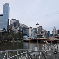
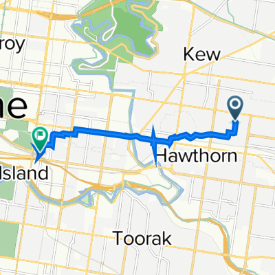
Training route loop
A cycling route starting in Hawthorn East, Victoria, Australia.
Overview
About this route
Training loop
- -:--
- Duration
- 38.8 km
- Distance
- 328 m
- Ascent
- 327 m
- Descent
- ---
- Avg. speed
- 111 m
- Max. altitude
Route quality
Waytypes & surfaces along the route
Waytypes
Cycleway
27.6 km
(71 %)
Quiet road
6.3 km
(16 %)
Surfaces
Paved
28.1 km
(73 %)
Unpaved
6.4 km
(17 %)
Asphalt
20.6 km
(53 %)
Unpaved (undefined)
4.8 km
(12 %)
Continue with Bikemap
Use, edit, or download this cycling route
You would like to ride Training route loop or customize it for your own trip? Here is what you can do with this Bikemap route:
Free features
- Save this route as favorite or in collections
- Copy & plan your own version of this route
- Sync your route with Garmin or Wahoo
Premium features
Free trial for 3 days, or one-time payment. More about Bikemap Premium.
- Navigate this route on iOS & Android
- Export a GPX / KML file of this route
- Create your custom printout (try it for free)
- Download this route for offline navigation
Discover more Premium features.
Get Bikemap PremiumFrom our community
Other popular routes starting in Hawthorn East
 TA Building to Kooyongkoot Road
- Distance
- 25.2 km
- Ascent
- 153 m
- Descent
- 163 m
- Location
- Hawthorn East, Victoria, Australia
 Easy Ride
- Distance
- 26.4 km
- Ascent
- 183 m
- Descent
- 183 m
- Location
- Hawthorn East, Victoria, Australia
 165 Power Street, Hawthorn to 20 Peel Street, Collingwood
- Distance
- 23.6 km
- Ascent
- 3 m
- Descent
- 21 m
- Location
- Hawthorn East, Victoria, Australia
 Lengthy bike tour through Hawthorn East
- Distance
- 31.8 km
- Ascent
- 161 m
- Descent
- 161 m
- Location
- Hawthorn East, Victoria, Australia
 ride2work day
- Distance
- 6.3 km
- Ascent
- 20 m
- Descent
- 61 m
- Location
- Hawthorn East, Victoria, Australia
 Training route loop
- Distance
- 38.8 km
- Ascent
- 328 m
- Descent
- 327 m
- Location
- Hawthorn East, Victoria, Australia
 57 Haines St, Hawthorn to 57 Long View Rd, Croydon South
- Distance
- 56.1 km
- Ascent
- 442 m
- Descent
- 351 m
- Location
- Hawthorn East, Victoria, Australia
 studs, short cut home
- Distance
- 38.3 km
- Ascent
- 397 m
- Descent
- 398 m
- Location
- Hawthorn East, Victoria, Australia
Open it in the app