

Trier - Wasserbillig
A cycling route starting in Igel, Rhineland-Palatinate, Germany.
Overview
About this route
- 1 h 50 min
- Duration
- 24.9 km
- Distance
- 175 m
- Ascent
- 173 m
- Descent
- 13.6 km/h
- Avg. speed
- 152 m
- Max. altitude
Route photos


Route quality
Waytypes & surfaces along the route
Waytypes
Path
10 km
(40 %)
Track
6.5 km
(26 %)
Surfaces
Paved
22.4 km
(90 %)
Unpaved
1.2 km
(5 %)
Asphalt
22.2 km
(89 %)
Loose gravel
0.7 km
(3 %)
Continue with Bikemap
Use, edit, or download this cycling route
You would like to ride Trier - Wasserbillig or customize it for your own trip? Here is what you can do with this Bikemap route:
Free features
- Save this route as favorite or in collections
- Copy & plan your own version of this route
- Sync your route with Garmin or Wahoo
Premium features
Free trial for 3 days, or one-time payment. More about Bikemap Premium.
- Navigate this route on iOS & Android
- Export a GPX / KML file of this route
- Create your custom printout (try it for free)
- Download this route for offline navigation
Discover more Premium features.
Get Bikemap PremiumFrom our community
Other popular routes starting in Igel
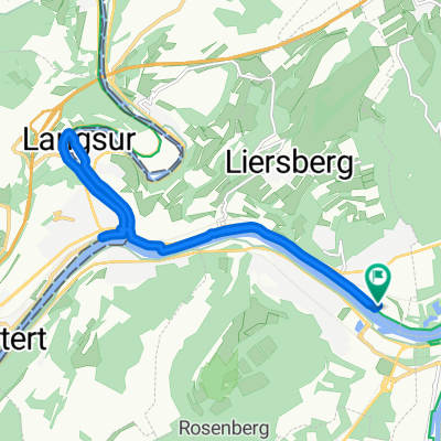 Langsur
- Distance
- 12.3 km
- Ascent
- 129 m
- Descent
- 139 m
- Location
- Igel, Rhineland-Palatinate, Germany
 Trier - Trittenheim
- Distance
- 46.3 km
- Ascent
- 99 m
- Descent
- 117 m
- Location
- Igel, Rhineland-Palatinate, Germany
 Turmstraße 37, Trier nach Turmstraße 41, Trier
- Distance
- 13.2 km
- Ascent
- 59 m
- Descent
- 60 m
- Location
- Igel, Rhineland-Palatinate, Germany
 PM1
PM1- Distance
- 23.9 km
- Ascent
- 338 m
- Descent
- 335 m
- Location
- Igel, Rhineland-Palatinate, Germany
 PM2
PM2- Distance
- 18.5 km
- Ascent
- 53 m
- Descent
- 53 m
- Location
- Igel, Rhineland-Palatinate, Germany
 trier-trierweiler-trier
- Distance
- 28.6 km
- Ascent
- 464 m
- Descent
- 463 m
- Location
- Igel, Rhineland-Palatinate, Germany
 Zewen - Echternach - Zewen mit Berg
- Distance
- 57.5 km
- Ascent
- 899 m
- Descent
- 902 m
- Location
- Igel, Rhineland-Palatinate, Germany
 PS1
PS1- Distance
- 13.7 km
- Ascent
- 86 m
- Descent
- 85 m
- Location
- Igel, Rhineland-Palatinate, Germany
Open it in the app