


Desafío al Cañon de Pablin - MTB - Definitivo
A cycling route starting in Los Altos, Catamarca Province, Argentina.
Overview
About this route
0
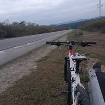
Circuit of the Expedition MTB modality for the race IDesafío al Cañon de Paclin, to be held on October 28, 2012.
Mandatory items for participants:
Mountain bike in good condition
Helmet
Gloves
Headlight or bike light (to cross the 2km tunnel, very dark)
Ziploc bag or similar to safeguard race passport.
1/2 liter of water
First aid kit
To register or for more information, visit www.ecocatamarca.com.ar
- -:--
- Duration
- 46.8 km
- Distance
- 960 m
- Ascent
- 960 m
- Descent
- ---
- Avg. speed
- ---
- Max. altitude
Juank Leon del Ambato
created this 14 years ago
Continue with Bikemap
Use, edit, or download this cycling route
You would like to ride Desafío al Cañon de Pablin - MTB - Definitivo or customize it for your own trip? Here is what you can do with this Bikemap route:
Free features
- Save this route as favorite or in collections
- Copy & plan your own version of this route
- Sync your route with Garmin or Wahoo
Premium features
Free trial for 3 days, or one-time payment. More about Bikemap Premium.
- Navigate this route on iOS & Android
- Export a GPX / KML file of this route
- Create your custom printout (try it for free)
- Download this route for offline navigation
Discover more Premium features.
Get Bikemap PremiumFrom our community
Other popular routes starting in Los Altos


 Desafío al Cañon de Pablin - MTB - Definitivo0
- 46.8 km
- 989 m
- 989 m
- Los Altos, Catamarca Province, Argentina


Open it in the app