

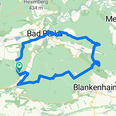
Recovered Route
A cycling route starting in Bad Berka, Thuringia, Germany.
Overview
About this route
- 2 h 12 min
- Duration
- 30.6 km
- Distance
- 708 m
- Ascent
- 648 m
- Descent
- 13.9 km/h
- Avg. speed
- 339 m
- Max. altitude

Route quality
Waytypes & surfaces along the route
Waytypes
Track
10.7 km
(35 %)
Path
5.8 km
(19 %)
Surfaces
Paved
19.9 km
(65 %)
Unpaved
7 km
(23 %)
Asphalt
18.7 km
(61 %)
Gravel
2.4 km
(8 %)
Continue with Bikemap
Use, edit, or download this cycling route
You would like to ride Recovered Route or customize it for your own trip? Here is what you can do with this Bikemap route:
Free features
- Save this route as favorite or in collections
- Copy & plan your own version of this route
- Sync your route with Garmin or Wahoo
Premium features
Free trial for 3 days, or one-time payment. More about Bikemap Premium.
- Navigate this route on iOS & Android
- Export a GPX / KML file of this route
- Create your custom printout (try it for free)
- Download this route for offline navigation
Discover more Premium features.
Get Bikemap PremiumFrom our community
Other popular routes starting in Bad Berka
 München(Bad Berka)-Paulinenturm-Ilm-München
- Distance
- 24.5 km
- Ascent
- 515 m
- Descent
- 531 m
- Location
- Bad Berka, Thuringia, Germany
 Rundtour Bad Berka-Blankenhain-Mellingen-Bad Berka
- Distance
- 45.9 km
- Ascent
- 319 m
- Descent
- 357 m
- Location
- Bad Berka, Thuringia, Germany
 Bad Berka Runde CLONED FROM ROUTE 329476
- Distance
- 46.1 km
- Ascent
- 681 m
- Descent
- 680 m
- Location
- Bad Berka, Thuringia, Germany
 DreiTürme
- Distance
- 16.6 km
- Ascent
- 384 m
- Descent
- 383 m
- Location
- Bad Berka, Thuringia, Germany
 Weimarische Straße 31, Bad Berka do Straße ohne Straßennamen, Tonndorf
- Distance
- 12.3 km
- Ascent
- 172 m
- Descent
- 131 m
- Location
- Bad Berka, Thuringia, Germany
 Blankenhainer Straße 6A, Bad Berka nach Kleinhettstedt 69, Stadtilm
- Distance
- 20.4 km
- Ascent
- 275 m
- Descent
- 203 m
- Location
- Bad Berka, Thuringia, Germany
 50.889° N 11.264° W nach 50.892° N 11.269° W
- Distance
- 36.3 km
- Ascent
- 429 m
- Descent
- 430 m
- Location
- Bad Berka, Thuringia, Germany
 Rundfahrt Bad Berka
- Distance
- 19.5 km
- Ascent
- 195 m
- Descent
- 193 m
- Location
- Bad Berka, Thuringia, Germany
Open it in the app