

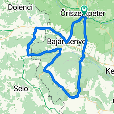
Őriszentpéter Hársas tó 34km
A cycling route starting in Zalalövő, Zala County, Hungary.
Overview
About this route
Őriszentpéter Hársas tó 34km
- -:--
- Duration
- 34.6 km
- Distance
- 505 m
- Ascent
- 507 m
- Descent
- ---
- Avg. speed
- 318 m
- Max. altitude

Route quality
Waytypes & surfaces along the route
Waytypes
Busy road
26.1 km
(76 %)
Track
5.1 km
(15 %)
Surfaces
Paved
19.7 km
(57 %)
Unpaved
6 km
(17 %)
Asphalt
18.7 km
(54 %)
Gravel
4.8 km
(14 %)
Continue with Bikemap
Use, edit, or download this cycling route
You would like to ride Őriszentpéter Hársas tó 34km or customize it for your own trip? Here is what you can do with this Bikemap route:
Free features
- Save this route as favorite or in collections
- Copy & plan your own version of this route
- Sync your route with Garmin or Wahoo
Premium features
Free trial for 3 days, or one-time payment. More about Bikemap Premium.
- Navigate this route on iOS & Android
- Export a GPX / KML file of this route
- Create your custom printout (try it for free)
- Download this route for offline navigation
Discover more Premium features.
Get Bikemap PremiumFrom our community
Other popular routes starting in Zalalövő
 Őrség 1 Kerékpárútvonal
- Distance
- 33.8 km
- Ascent
- 241 m
- Descent
- 246 m
- Location
- Zalalövő, Zala County, Hungary
 Őrség kör
- Distance
- 54.2 km
- Ascent
- 890 m
- Descent
- 661 m
- Location
- Zalalövő, Zala County, Hungary
 Őrség túra 62km
- Distance
- 61.6 km
- Ascent
- 270 m
- Descent
- 260 m
- Location
- Zalalövő, Zala County, Hungary
 Vendvidék - Goricko kör
- Distance
- 85.6 km
- Ascent
- 632 m
- Descent
- 619 m
- Location
- Zalalövő, Zala County, Hungary
 Oriszentpeter 1
- Distance
- 47.7 km
- Ascent
- 355 m
- Descent
- 355 m
- Location
- Zalalövő, Zala County, Hungary
 Őrség 3.
- Distance
- 63.2 km
- Ascent
- 196 m
- Descent
- 218 m
- Location
- Zalalövő, Zala County, Hungary
 Nemzeti Összetartozás Napja 2017. (Őrség - Goricko)
- Distance
- 49.5 km
- Ascent
- 344 m
- Descent
- 360 m
- Location
- Zalalövő, Zala County, Hungary
 Őriszentpétertől dékeletre 28km
- Distance
- 28 km
- Ascent
- 203 m
- Descent
- 201 m
- Location
- Zalalövő, Zala County, Hungary
Open it in the app