

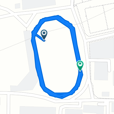
지묘동 229−7 to 연경동 769−13
A cycling route starting in Daegu, Daegu, South Korea.
Overview
About this route
- 16 min
- Duration
- 4.1 km
- Distance
- 17 m
- Ascent
- 43 m
- Descent
- 15.3 km/h
- Avg. speed
- 69 m
- Max. altitude

Continue with Bikemap
Use, edit, or download this cycling route
You would like to ride 지묘동 229−7 to 연경동 769−13 or customize it for your own trip? Here is what you can do with this Bikemap route:
Free features
- Save this route as favorite or in collections
- Copy & plan your own version of this route
- Sync your route with Garmin or Wahoo
Premium features
Free trial for 3 days, or one-time payment. More about Bikemap Premium.
- Navigate this route on iOS & Android
- Export a GPX / KML file of this route
- Create your custom printout (try it for free)
- Download this route for offline navigation
Discover more Premium features.
Get Bikemap PremiumFrom our community
Other popular routes starting in Daegu
 Route from 복현동 163-22
- Distance
- 12 km
- Ascent
- 48 m
- Descent
- 53 m
- Location
- Daegu, Daegu, South Korea
 대현동, 대구광역시에서 대현동, 대구광역시까지
- Distance
- 4 km
- Ascent
- 14 m
- Descent
- 9 m
- Location
- Daegu, Daegu, South Korea
 Korea Coast
- Distance
- 783.2 km
- Ascent
- 379 m
- Descent
- 405 m
- Location
- Daegu, Daegu, South Korea
 Supersonic route
- Distance
- 16.7 km
- Ascent
- 8 m
- Descent
- 10 m
- Location
- Daegu, Daegu, South Korea
 daegu to pohang
- Distance
- 85.3 km
- Ascent
- 231 m
- Descent
- 362 m
- Location
- Daegu, Daegu, South Korea
 신암동 1517 to 산격2동 690
- Distance
- 8.7 km
- Ascent
- 0 m
- Descent
- 4 m
- Location
- Daegu, Daegu, South Korea
 Work Ride
- Distance
- 31.2 km
- Ascent
- 272 m
- Descent
- 364 m
- Location
- Daegu, Daegu, South Korea
 신암2동 477-16 to 신암2동 475-60
- Distance
- 9.1 km
- Ascent
- 93 m
- Descent
- 101 m
- Location
- Daegu, Daegu, South Korea
Open it in the app