

Sněžník Trail
A cycling route starting in Libouchec, Ústecký kraj, Czechia.
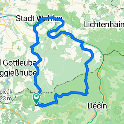
Overview
About this route
Very nice route with views of the Elbe Valley. The route has a lot of fun factor. You can also skip the long climb to Sneznik on the official cycling route by integrating some hiking trails. We will come back.
- -:--
- Duration
- 38.6 km
- Distance
- 668 m
- Ascent
- 683 m
- Descent
- ---
- Avg. speed
- ---
- Max. altitude

Continue with Bikemap
Use, edit, or download this cycling route
You would like to ride Sněžník Trail or customize it for your own trip? Here is what you can do with this Bikemap route:
Free features
- Save this route as favorite or in collections
- Copy & plan your own version of this route
- Sync your route with Garmin or Wahoo
Premium features
Free trial for 3 days, or one-time payment. More about Bikemap Premium.
- Navigate this route on iOS & Android
- Export a GPX / KML file of this route
- Create your custom printout (try it for free)
- Download this route for offline navigation
Discover more Premium features.
Get Bikemap PremiumFrom our community
Other popular routes starting in Libouchec
 Tisa-Lilienstein
- Distance
- 76.3 km
- Ascent
- 863 m
- Descent
- 1,039 m
- Location
- Libouchec, Ústecký kraj, Czechia
 Anspruchsvolle Osterzgebirgsrunde
- Distance
- 133.4 km
- Ascent
- 1,909 m
- Descent
- 2,079 m
- Location
- Libouchec, Ústecký kraj, Czechia
 HRH_2008_den_8
- Distance
- 44.2 km
- Ascent
- 489 m
- Descent
- 794 m
- Location
- Libouchec, Ústecký kraj, Czechia
 Ostrov nach Jetrichovice
- Distance
- 83 km
- Ascent
- 940 m
- Descent
- 940 m
- Location
- Libouchec, Ústecký kraj, Czechia
 Emilova cesta
- Distance
- 8.1 km
- Ascent
- 311 m
- Descent
- 317 m
- Location
- Libouchec, Ústecký kraj, Czechia
 13. Tisá-Ostrov-Rosental-Konigstein-BadSchandau-Dolní Žleb-Děčín-Velké Březno-přívoz-Neštěmice-UL
- Distance
- 84.3 km
- Ascent
- 935 m
- Descent
- 1,337 m
- Location
- Libouchec, Ústecký kraj, Czechia
 Tisá - Altenberg a zpět
- Distance
- 60.2 km
- Ascent
- 804 m
- Descent
- 806 m
- Location
- Libouchec, Ústecký kraj, Czechia
 Tisá, Tisá do Tisá, Tisá
- Distance
- 20.4 km
- Ascent
- 547 m
- Descent
- 544 m
- Location
- Libouchec, Ústecký kraj, Czechia
Open it in the app