

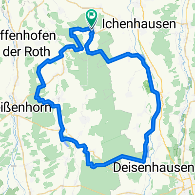
Günz-Bibertal-Tour
A cycling route starting in Rieden an der Kötz, Bavaria, Germany.
Overview
About this route
A beautiful tour from the Günztal to the very beautiful Bibertal. The route is attractive, both for scenic and sporty reasons. And it can sometimes be quite prone to wind, which makes it a bit 'sportier'.
Caution is advised at three critical points. In Oberhausen at the turn towards Biberach, because it is right behind a curve. Followers, please indicate your intention to turn in good time, as they sometimes follow closely and otherwise might 'kiss' with the rear wheel.
In Schießen, the intersection when turning onto the priority road is very late to recognize, also because the give way sign is hardly visible (often overgrown). And in Oxenbronn, drivers sometimes navigate in a somewhat 'confused' manner.
Otherwise, everything is in a very green area, especially in Bibertal, which must simply please people.
- -:--
- Duration
- 40.6 km
- Distance
- 195 m
- Ascent
- 195 m
- Descent
- ---
- Avg. speed
- ---
- Max. altitude
Route quality
Waytypes & surfaces along the route
Waytypes
Road
24 km
(59 %)
Cycleway
2.8 km
(7 %)
Surfaces
Paved
39 km
(96 %)
Asphalt
39 km
(96 %)
Undefined
1.6 km
(4 %)
Continue with Bikemap
Use, edit, or download this cycling route
You would like to ride Günz-Bibertal-Tour or customize it for your own trip? Here is what you can do with this Bikemap route:
Free features
- Save this route as favorite or in collections
- Copy & plan your own version of this route
- Sync your route with Garmin or Wahoo
Premium features
Free trial for 3 days, or one-time payment. More about Bikemap Premium.
- Navigate this route on iOS & Android
- Export a GPX / KML file of this route
- Create your custom printout (try it for free)
- Download this route for offline navigation
Discover more Premium features.
Get Bikemap PremiumFrom our community
Other popular routes starting in Rieden an der Kötz
 Autenried-Babenhausen-Kellmünz-Autenried
- Distance
- 92.3 km
- Ascent
- 644 m
- Descent
- 641 m
- Location
- Rieden an der Kötz, Bavaria, Germany
 2-Täler-Runde
- Distance
- 22.5 km
- Ascent
- 201 m
- Descent
- 202 m
- Location
- Rieden an der Kötz, Bavaria, Germany
 Günz-Bibertal-Tour
- Distance
- 40.6 km
- Ascent
- 195 m
- Descent
- 195 m
- Location
- Rieden an der Kötz, Bavaria, Germany
 Graveltour Autenried - Autenried
- Distance
- 48 km
- Ascent
- 0 m
- Descent
- 0 m
- Location
- Rieden an der Kötz, Bavaria, Germany
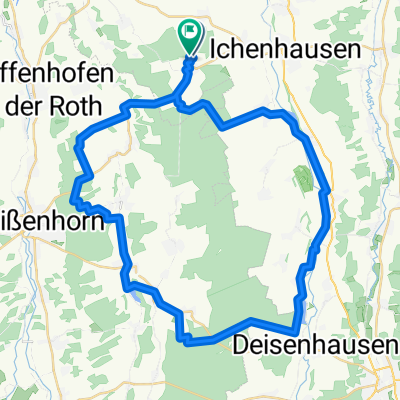
 alternative Günz-Bibertal-Route über Ichenhausen
- Distance
- 39.8 km
- Ascent
- 201 m
- Descent
- 201 m
- Location
- Rieden an der Kötz, Bavaria, Germany
 Autenried-Wasserberg-Burg-Autenried Gravel
- Distance
- 96.5 km
- Ascent
- 473 m
- Descent
- 471 m
- Location
- Rieden an der Kötz, Bavaria, Germany
 Große Bibertalroute
- Distance
- 42.5 km
- Ascent
- 170 m
- Descent
- 170 m
- Location
- Rieden an der Kötz, Bavaria, Germany
 Graveltour-Autenried-Roggenburg-Marienfried-Autenried
- Distance
- 45.7 km
- Ascent
- 457 m
- Descent
- 451 m
- Location
- Rieden an der Kötz, Bavaria, Germany
Open it in the app