

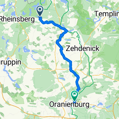
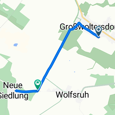
E 18 80/1.351 C.Wentowsee - C.Kanu Hecht
A cycling route starting in Großwoltersdorf, Brandenburg, Germany.
Overview
About this route
- -:--
- Duration
- 80.1 km
- Distance
- 628 m
- Ascent
- 615 m
- Descent
- ---
- Avg. speed
- 94 m
- Max. altitude

Route quality
Waytypes & surfaces along the route
Waytypes
Quiet road
31.2 km
(39 %)
Road
19.2 km
(24 %)
Surfaces
Paved
59.3 km
(74 %)
Unpaved
8 km
(10 %)
Asphalt
54.5 km
(68 %)
Gravel
4 km
(5 %)
Continue with Bikemap
Use, edit, or download this cycling route
You would like to ride E 18 80/1.351 C.Wentowsee - C.Kanu Hecht or customize it for your own trip? Here is what you can do with this Bikemap route:
Free features
- Save this route as favorite or in collections
- Copy & plan your own version of this route
- Split it into stages to create a multi-day tour
- Sync your route with Garmin or Wahoo
Premium features
Free trial for 3 days, or one-time payment. More about Bikemap Premium.
- Navigate this route on iOS & Android
- Export a GPX / KML file of this route
- Create your custom printout (try it for free)
- Download this route for offline navigation
Discover more Premium features.
Get Bikemap PremiumFrom our community
Other popular routes starting in Großwoltersdorf
 Bikepack tour délicieux
- Distance
- 81.8 km
- Ascent
- 441 m
- Descent
- 449 m
- Location
- Großwoltersdorf, Brandenburg, Germany
 20160626_133401.gpx
- Distance
- 59.2 km
- Ascent
- 128 m
- Descent
- 172 m
- Location
- Großwoltersdorf, Brandenburg, Germany
 6.Etappe: Großwoltersdorf (Burow) - Wandlitz 62 km
- Distance
- 61.8 km
- Ascent
- 308 m
- Descent
- 311 m
- Location
- Großwoltersdorf, Brandenburg, Germany
 Stechlin Lychen Templin
- Distance
- 72.4 km
- Ascent
- 582 m
- Descent
- 577 m
- Location
- Großwoltersdorf, Brandenburg, Germany
 E 18 80/1.351 C.Wentowsee - C.Kanu Hecht
- Distance
- 80.1 km
- Ascent
- 628 m
- Descent
- 615 m
- Location
- Großwoltersdorf, Brandenburg, Germany
 Siedlungsweg 4, Großwoltersdorf nach Großwoltersdorfer Weg, Großwoltersdorf
- Distance
- 3.5 km
- Ascent
- 6 m
- Descent
- 3 m
- Location
- Großwoltersdorf, Brandenburg, Germany
 Wanderung zu Dietrichs Teerofen
- Distance
- 6.8 km
- Ascent
- 56 m
- Descent
- 57 m
- Location
- Großwoltersdorf, Brandenburg, Germany
 Tour de Kratzeburg
- Distance
- 155.4 km
- Ascent
- 343 m
- Descent
- 348 m
- Location
- Großwoltersdorf, Brandenburg, Germany
Open it in the app