

Rheinroute
A cycling route starting in Andermatt, Canton of Uri, Switzerland.
Overview
About this route
Rheinroute
- -:--
- Duration
- 380.7 km
- Distance
- 2,858 m
- Ascent
- 4,032 m
- Descent
- ---
- Avg. speed
- 2,050 m
- Max. altitude

Route quality
Waytypes & surfaces along the route
Waytypes
Quiet road
102.8 km
(27 %)
Track
95.2 km
(25 %)
Surfaces
Paved
342.6 km
(90 %)
Unpaved
34.3 km
(9 %)
Asphalt
342.6 km
(90 %)
Gravel
22.8 km
(6 %)
Continue with Bikemap
Use, edit, or download this cycling route
You would like to ride Rheinroute or customize it for your own trip? Here is what you can do with this Bikemap route:
Free features
- Save this route as favorite or in collections
- Copy & plan your own version of this route
- Split it into stages to create a multi-day tour
- Sync your route with Garmin or Wahoo
Premium features
Free trial for 3 days, or one-time payment. More about Bikemap Premium.
- Navigate this route on iOS & Android
- Export a GPX / KML file of this route
- Create your custom printout (try it for free)
- Download this route for offline navigation
Discover more Premium features.
Get Bikemap PremiumFrom our community
Other popular routes starting in Andermatt
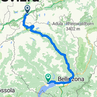
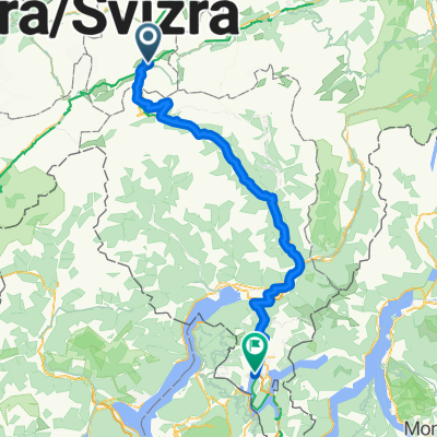 Bellinzona - Vizzola Ticino
- Distance
- 130.7 km
- Ascent
- 2,639 m
- Descent
- 3,799 m
- Location
- Andermatt, Canton of Uri, Switzerland
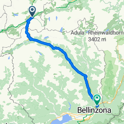
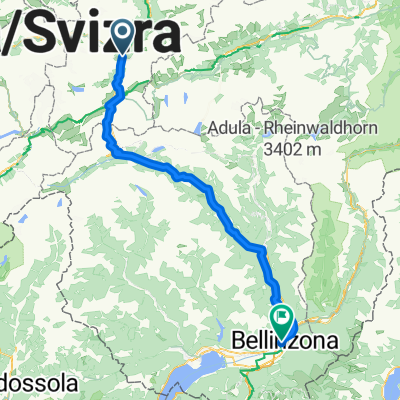 Tag 3: Andermatt - Bellinzona
- Distance
- 100 km
- Ascent
- 2,518 m
- Descent
- 3,216 m
- Location
- Andermatt, Canton of Uri, Switzerland
 VR01 Furkapass Belvedere-Brig.kml - VR01 Furkapass Belvedere-Brig.kml_VR01 Furkapass Belvedere-Brig
- Distance
- 60.1 km
- Ascent
- 852 m
- Descent
- 2,409 m
- Location
- Andermatt, Canton of Uri, Switzerland
 Furkastrasse, Realp nach Ritystrasse, Brigerbad
- Distance
- 70.6 km
- Ascent
- 558 m
- Descent
- 2,246 m
- Location
- Andermatt, Canton of Uri, Switzerland
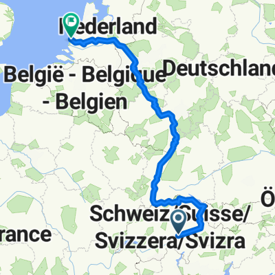 NL The Rhine Cycle Route
- Distance
- 1,352.1 km
- Ascent
- 88 m
- Descent
- 1,523 m
- Location
- Andermatt, Canton of Uri, Switzerland
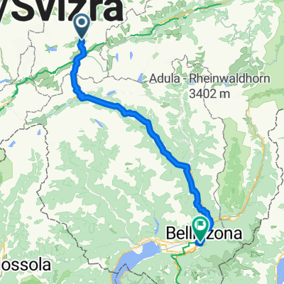
 Von Andermatt bis Locarno
- Distance
- 115.9 km
- Ascent
- 2,182 m
- Descent
- 3,407 m
- Location
- Andermatt, Canton of Uri, Switzerland
 Andermatt -Bellinzona Gotthardstrasse to Via San Gottardo
- Distance
- 80.7 km
- Ascent
- 708 m
- Descent
- 1,919 m
- Location
- Andermatt, Canton of Uri, Switzerland
 Tag 3: Göschenen - Giubiasco (Bellinzona)
- Distance
- 105.5 km
- Ascent
- 1,280 m
- Descent
- 2,197 m
- Location
- Andermatt, Canton of Uri, Switzerland
Open it in the app