

Schwarze Heide
A cycling route starting in Oberhausen, North Rhine-Westphalia, Germany.
Overview
About this route
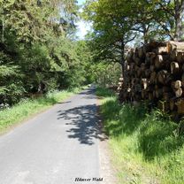
Wooded route, mostly on car-free paths. At the Schwarze Heide airfield, there is a restaurant. For self-caterers, good resting opportunities at Heidhof.
- -:--
- Duration
- 51.4 km
- Distance
- 285 m
- Ascent
- 285 m
- Descent
- ---
- Avg. speed
- 78 m
- Max. altitude

Route photos


Route quality
Waytypes & surfaces along the route
Waytypes
Track
25.2 km
(49 %)
Path
15.9 km
(31 %)
Surfaces
Paved
15.9 km
(31 %)
Unpaved
31.9 km
(62 %)
Gravel
27.2 km
(53 %)
Asphalt
15.9 km
(31 %)
Continue with Bikemap
Use, edit, or download this cycling route
You would like to ride Schwarze Heide or customize it for your own trip? Here is what you can do with this Bikemap route:
Free features
- Save this route as favorite or in collections
- Copy & plan your own version of this route
- Sync your route with Garmin or Wahoo
Premium features
Free trial for 3 days, or one-time payment. More about Bikemap Premium.
- Navigate this route on iOS & Android
- Export a GPX / KML file of this route
- Create your custom printout (try it for free)
- Download this route for offline navigation
Discover more Premium features.
Get Bikemap PremiumFrom our community
Other popular routes starting in Oberhausen
 Hünxer Wald 2
- Distance
- 61.2 km
- Ascent
- 397 m
- Descent
- 401 m
- Location
- Oberhausen, North Rhine-Westphalia, Germany
 Bahntrasse in Oberhausen
- Distance
- 29.5 km
- Ascent
- 58 m
- Descent
- 70 m
- Location
- Oberhausen, North Rhine-Westphalia, Germany
 Runde 21 km
- Distance
- 20.6 km
- Ascent
- 94 m
- Descent
- 87 m
- Location
- Oberhausen, North Rhine-Westphalia, Germany
 Oberhausen-Essen-Ruhr
- Distance
- 27.2 km
- Ascent
- 221 m
- Descent
- 202 m
- Location
- Oberhausen, North Rhine-Westphalia, Germany
 Tourenatlas Ruhrgebiet Tour 1
- Distance
- 32.6 km
- Ascent
- 131 m
- Descent
- 148 m
- Location
- Oberhausen, North Rhine-Westphalia, Germany
 Olga zur Ruhr und Baldeneysee
- Distance
- 102.4 km
- Ascent
- 123 m
- Descent
- 119 m
- Location
- Oberhausen, North Rhine-Westphalia, Germany
 Mülheimer Str bis Ackerfährbrücke
- Distance
- 15.1 km
- Ascent
- 21 m
- Descent
- 24 m
- Location
- Oberhausen, North Rhine-Westphalia, Germany
 Rundweg Rotbach-Rhein-Emscher mit Lokal Zur Arche
- Distance
- 52.2 km
- Ascent
- 141 m
- Descent
- 142 m
- Location
- Oberhausen, North Rhine-Westphalia, Germany
Open it in the app