

Basic Runde 1
A cycling route starting in Gillenfeld, Rhineland-Palatinate, Germany.
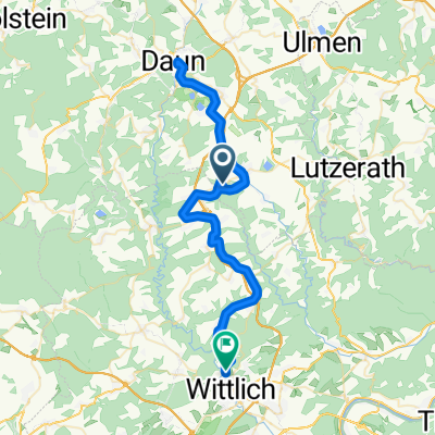
Overview
About this route
- -:--
- Duration
- 8.1 km
- Distance
- 120 m
- Ascent
- 115 m
- Descent
- ---
- Avg. speed
- ---
- Max. altitude

Route highlights
Points of interest along the route
Point of interest after 0.8 km
1. Übungspkt >Balance >Langsam fahren >Anfahren am Berg
Point of interest after 1.3 km
2. Ü-Pkt Rucksack ablegen lassen! >Grundpostition >Flexibilität auf dem Bike=Gewichtsverlagerung, vor und hinter den Sattel, links und rechts neben das Rad >leichtes Springen mit dem Rad >Kreise und Acht >Vorderrad anheben, Vorstufe zum Weehli >Hinterrad anheben: Vorderradbremse, Hinterrad leicht machen, Vorstufe zum Hinterrad umsetzen, gleichzeitig Bremsenvorübung >Vollbremsung=Notbremsung dazu statische Vorübung Bremshaltung: Hinterrad auf dortiger Bank-Aufsteigen auf das von Ausbilder gehaltene Rad >Notbremsung
Point of interest after 2.9 km
3. Ü-Pkt kleiner Trail zum Holzmaar Trail hochfahren >Gangwahl >Linie >Position >Kraft und Geschicklichkeit ggfs unterstützt der Trainer mit Handschub
Point of interest after 4.1 km
4. Ü-Pkt Steilauffahrt, 20m lang zuziehend Rucksack ablegen lassen! > Position Druck auf den Lenker, Hintern auf die Sattelspitze >> aber erst dann WENN und nur so viel WIE erforderlich!!! >Anfahren im steilen Berg aufwärts und abwärts
Accommodation after 5.7 km
Kleine leichte Abfahrt 50m lang ins Tal
Point of interest after 6.1 km
6. Ü-Pkt Waldweg mit geringem Gefälle > Kleines Hindernis überfahren/Überspringen anfangs ohne Hindernis(Stock oder Linie oder Hütchen) dann über kleinen Baumstann
Continue with Bikemap
Use, edit, or download this cycling route
You would like to ride Basic Runde 1 or customize it for your own trip? Here is what you can do with this Bikemap route:
Free features
- Save this route as favorite or in collections
- Copy & plan your own version of this route
- Sync your route with Garmin or Wahoo
Premium features
Free trial for 3 days, or one-time payment. More about Bikemap Premium.
- Navigate this route on iOS & Android
- Export a GPX / KML file of this route
- Create your custom printout (try it for free)
- Download this route for offline navigation
Discover more Premium features.
Get Bikemap PremiumFrom our community
Other popular routes starting in Gillenfeld
 rund um manderscheidt
- Distance
- 39.8 km
- Ascent
- 602 m
- Descent
- 605 m
- Location
- Gillenfeld, Rhineland-Palatinate, Germany
 gillenfeld_02
- Distance
- 45.8 km
- Ascent
- 686 m
- Descent
- 687 m
- Location
- Gillenfeld, Rhineland-Palatinate, Germany
 Holzmaarstraße 57, Gillenfeld nach Holzmaarstraße 57, Gillenfeld
- Distance
- 18.4 km
- Ascent
- 231 m
- Descent
- 229 m
- Location
- Gillenfeld, Rhineland-Palatinate, Germany
 Route nach Schloßstraße 32, Wittlich
- Distance
- 26.1 km
- Ascent
- 322 m
- Descent
- 557 m
- Location
- Gillenfeld, Rhineland-Palatinate, Germany
 Schnelle Tour in Wittlich
- Distance
- 51.8 km
- Ascent
- 429 m
- Descent
- 646 m
- Location
- Gillenfeld, Rhineland-Palatinate, Germany
 1. Fahrt: Gillenfelder Wald - Bengel
- Distance
- 53.2 km
- Ascent
- 382 m
- Descent
- 722 m
- Location
- Gillenfeld, Rhineland-Palatinate, Germany
 Holzmaarstraße 57, Gillenfeld nach Holzmaarstraße 57, Gillenfeld
- Distance
- 49.1 km
- Ascent
- 810 m
- Descent
- 813 m
- Location
- Gillenfeld, Rhineland-Palatinate, Germany
 Aussicht Holzmaar
- Distance
- 0.6 km
- Ascent
- 8 m
- Descent
- 22 m
- Location
- Gillenfeld, Rhineland-Palatinate, Germany
Open it in the app