

Cycling the Alps Signal de Bisanne (1930m)
A cycling route starting in Ugine, Auvergne-Rhône-Alpes, France.
Overview
About this route
Get following information of this pass
Video, Pictures, 3D Tour, Google Earth Data, Streetview, Profiles, Detailed descriptions, Wikipedia <div><img src="http://sites.google.com/a/cyclingthealps.com/cyclingthealps/other/logo/CTA_logo_black_small.png" border="0" alt="" /></div>
- -:--
- Duration
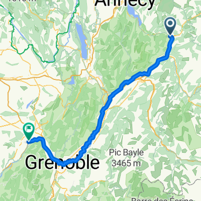
- 24.7 km
- Distance
- 962 m
- Ascent
- 1,231 m
- Descent
- ---
- Avg. speed
- ---
- Max. altitude

Route quality
Waytypes & surfaces along the route
Waytypes
Road
12.1 km
(49 %)
Track
7.9 km
(32 %)
Surfaces
Paved
14.6 km
(59 %)
Unpaved
7.4 km
(30 %)
Asphalt
13.9 km
(56 %)
Gravel
7.2 km
(29 %)
Continue with Bikemap
Use, edit, or download this cycling route
You would like to ride Cycling the Alps Signal de Bisanne (1930m) or customize it for your own trip? Here is what you can do with this Bikemap route:
Free features
- Save this route as favorite or in collections
- Copy & plan your own version of this route
- Sync your route with Garmin or Wahoo
Premium features
Free trial for 3 days, or one-time payment. More about Bikemap Premium.
- Navigate this route on iOS & Android
- Export a GPX / KML file of this route
- Create your custom printout (try it for free)
- Download this route for offline navigation
Discover more Premium features.
Get Bikemap PremiumFrom our community
Other popular routes starting in Ugine
 Ugine Col d'Arpetaz 2600 HM 62KM
- Distance
- 61.1 km
- Ascent
- 2,655 m
- Descent
- 2,654 m
- Location
- Ugine, Auvergne-Rhône-Alpes, France
 La Vilette - Col de Arpetaz 45 KM schwer
- Distance
- 42.5 km
- Ascent
- 1,691 m
- Descent
- 1,700 m
- Location
- Ugine, Auvergne-Rhône-Alpes, France
 Ugine - Aviernoz
- Distance
- 88.4 km
- Ascent
- 2,011 m
- Descent
- 1,651 m
- Location
- Ugine, Auvergne-Rhône-Alpes, France
 5 cols from Ugine
- Distance
- 79.5 km
- Ascent
- 1,893 m
- Descent
- 1,893 m
- Location
- Ugine, Auvergne-Rhône-Alpes, France
 Ugine - Le Giettaz 56km
- Distance
- 55 km
- Ascent
- 2,175 m
- Descent
- 2,175 m
- Location
- Ugine, Auvergne-Rhône-Alpes, France
 Westalpen Etappe 01 - Ugine
- Distance
- 131.8 km
- Ascent
- 2,299 m
- Descent
- 2,290 m
- Location
- Ugine, Auvergne-Rhône-Alpes, France
 Ugine - Saint-Quentin-sur-Isère
- Distance
- 128.4 km
- Ascent
- 324 m
- Descent
- 556 m
- Location
- Ugine, Auvergne-Rhône-Alpes, France
 Tour des aravis avec Mt Charvin curta
- Distance
- 76.1 km
- Ascent
- 1,683 m
- Descent
- 1,683 m
- Location
- Ugine, Auvergne-Rhône-Alpes, France
Open it in the app