

Ruta circular del Romanico Rural de Guadalajara
A cycling route starting in Cantalojas, Castille-La Mancha, Spain.
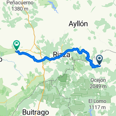
Overview
About this route
La presente ruta pasa por diferentes localidades de la zona, donde podras apreciar el arte del Romanico Rural en los siglos XII (especialmente). Las iglesias más representativas de este arte se encuentran en: Villacadima, Campisabalos y Albendiego. Esta última se encuentra a las afueras del pueblo y es de una gran belleza.
En Galve de Sorbe encontraras una picota romanica,.
Podras encontrar agua potable en todos los pueblos por los que pasa la ruta. Asimismo, también encontraras papeleras para dejar la basura que generes. Si no la encuentras cerca, por favor, guardala.
Esta ruta fue hecha el 13 de agosto de 2011 por Javier y Fernando.
- -:--
- Duration
- 41.3 km
- Distance
- 441 m
- Ascent
- 441 m
- Descent
- ---
- Avg. speed
- ---
- Max. altitude
Route quality
Waytypes & surfaces along the route
Waytypes
Road
14.9 km
(36 %)
Track
2.5 km
(6 %)
Surfaces
Paved
9.9 km
(24 %)
Asphalt
9.9 km
(24 %)
Undefined
31.4 km
(76 %)
Route highlights
Points of interest along the route
Point of interest after 41.2 km
Ruta circular del románico rural. Hecha por Javier y Fernando en Agosto de 2011
Continue with Bikemap
Use, edit, or download this cycling route
You would like to ride Ruta circular del Romanico Rural de Guadalajara or customize it for your own trip? Here is what you can do with this Bikemap route:
Free features
- Save this route as favorite or in collections
- Copy & plan your own version of this route
- Sync your route with Garmin or Wahoo
Premium features
Free trial for 3 days, or one-time payment. More about Bikemap Premium.
- Navigate this route on iOS & Android
- Export a GPX / KML file of this route
- Create your custom printout (try it for free)
- Download this route for offline navigation
Discover more Premium features.
Get Bikemap PremiumFrom our community
Other popular routes starting in Cantalojas
 cantalojas sepulveda
- Distance
- 62.1 km
- Ascent
- 584 m
- Descent
- 902 m
- Location
- Cantalojas, Castille-La Mancha, Spain
 Cantalojas_ayllon- Montejo de Tiermes
- Distance
- 54.4 km
- Ascent
- 463 m
- Descent
- 621 m
- Location
- Cantalojas, Castille-La Mancha, Spain
 Grado de Pico
- Distance
- 35.7 km
- Ascent
- 611 m
- Descent
- 607 m
- Location
- Cantalojas, Castille-La Mancha, Spain
 D0330 Cantalojas - Retortillo de Soria
- Distance
- 34.4 km
- Ascent
- 434 m
- Descent
- 548 m
- Location
- Cantalojas, Castille-La Mancha, Spain
 Dia3B. Cantalojas-Sigüenza (Por Umbralejo y Atienza)
- Distance
- 105.1 km
- Ascent
- 919 m
- Descent
- 1,230 m
- Location
- Cantalojas, Castille-La Mancha, Spain
 Hayedo de Tejera Negra - Campisábalos - Galve de Sorbe
- Distance
- 73 km
- Ascent
- 644 m
- Descent
- 709 m
- Location
- Cantalojas, Castille-La Mancha, Spain
 Cantalojas Majaelrayo
- Distance
- 22.9 km
- Ascent
- 557 m
- Descent
- 679 m
- Location
- Cantalojas, Castille-La Mancha, Spain
 Río Zarzas Cantalojas
- Distance
- 24.9 km
- Ascent
- 638 m
- Descent
- 521 m
- Location
- Cantalojas, Castille-La Mancha, Spain
Open it in the app