
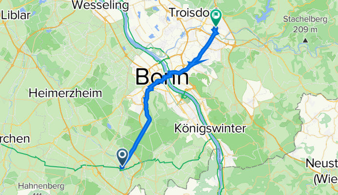
Auf dem Stephansberg 2, Meckenheim nach Ringstraße 11, Siegburg
A cycling route starting in Meckenheim, North Rhine-Westphalia, Germany.
Overview
About this route
- 1 h 11 min
- Duration
- 27.4 km
- Distance
- 74 m
- Ascent
- 186 m
- Descent
- 23.2 km/h
- Avg. speed
- 194 m
- Max. altitude
Route quality
Waytypes & surfaces along the route
Waytypes
Path
13.4 km
(49 %)
Quiet road
6.1 km
(22 %)
Surfaces
Paved
26.9 km
(98 %)
Asphalt
24.8 km
(90 %)
Paving stones
1.1 km
(4 %)
Continue with Bikemap
Use, edit, or download this cycling route
You would like to ride Auf dem Stephansberg 2, Meckenheim nach Ringstraße 11, Siegburg or customize it for your own trip? Here is what you can do with this Bikemap route:
Free features
- Save this route as favorite or in collections
- Copy & plan your own version of this route
- Sync your route with Garmin or Wahoo
Premium features
Free trial for 3 days, or one-time payment. More about Bikemap Premium.
- Navigate this route on iOS & Android
- Export a GPX / KML file of this route
- Create your custom printout (try it for free)
- Download this route for offline navigation
Discover more Premium features.
Get Bikemap PremiumFrom our community
Other popular routes starting in Meckenheim
 Trainingsrunde Meckem-Pech-Berkum
- Distance
- 44 km
- Ascent
- 485 m
- Descent
- 485 m
- Location
- Meckenheim, North Rhine-Westphalia, Germany
 Kottenforst-Runde
- Distance
- 18.5 km
- Ascent
- 104 m
- Descent
- 104 m
- Location
- Meckenheim, North Rhine-Westphalia, Germany
 Tomburg
- Distance
- 9.7 km
- Ascent
- 119 m
- Descent
- 21 m
- Location
- Meckenheim, North Rhine-Westphalia, Germany
 vom Kottenforst zum Königsforst
- Distance
- 64.6 km
- Ascent
- 173 m
- Descent
- 286 m
- Location
- Meckenheim, North Rhine-Westphalia, Germany
 Am Rebstock 11, Meckenheim nach Am Rebstock 22, Meckenheim
- Distance
- 14.2 km
- Ascent
- 86 m
- Descent
- 95 m
- Location
- Meckenheim, North Rhine-Westphalia, Germany
 Rheintal: Wine, Rhine and Romans
- Distance
- 266.2 km
- Ascent
- 6,602 m
- Descent
- 6,603 m
- Location
- Meckenheim, North Rhine-Westphalia, Germany
 Rund um Rheinbach, Ahr und Eifel
- Distance
- 62.6 km
- Ascent
- 440 m
- Descent
- 440 m
- Location
- Meckenheim, North Rhine-Westphalia, Germany
 Meckenheim - Rech
- Distance
- 44.7 km
- Ascent
- 760 m
- Descent
- 760 m
- Location
- Meckenheim, North Rhine-Westphalia, Germany
Open it in the app