
Pitlochry Aviemore - Pitlochry Aviemore
A cycling route starting in Pitlochry, Scotland, United Kingdom.
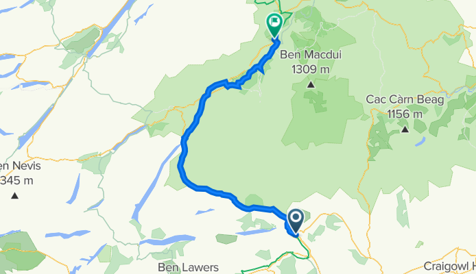
Overview
About this route
- -:--
- Duration
- 95.3 km
- Distance
- 765 m
- Ascent
- 647 m
- Descent
- ---
- Avg. speed
- 458 m
- Max. altitude

Route quality
Waytypes & surfaces along the route
Waytypes
Cycleway
29.5 km
(31 %)
Quiet road
14.3 km
(15 %)
Surfaces
Paved
45.7 km
(48 %)
Unpaved
1 km
(1 %)
Asphalt
45.7 km
(48 %)
Gravel
1 km
(1 %)
Undefined
48.6 km
(51 %)
Continue with Bikemap
Use, edit, or download this cycling route
You would like to ride Pitlochry Aviemore - Pitlochry Aviemore or customize it for your own trip? Here is what you can do with this Bikemap route:
Free features
- Save this route as favorite or in collections
- Copy & plan your own version of this route
- Split it into stages to create a multi-day tour
- Sync your route with Garmin or Wahoo
Premium features
Free trial for 3 days, or one-time payment. More about Bikemap Premium.
- Navigate this route on iOS & Android
- Export a GPX / KML file of this route
- Create your custom printout (try it for free)
- Download this route for offline navigation
Discover more Premium features.
Get Bikemap PremiumFrom our community
Other popular routes starting in Pitlochry
 dunkeld moulin
- Distance
- 21.9 km
- Ascent
- 180 m
- Descent
- 233 m
- Location
- Pitlochry, Scotland, United Kingdom
 Loch Tummel and Blair Atholl
- Distance
- 48.9 km
- Ascent
- 488 m
- Descent
- 488 m
- Location
- Pitlochry, Scotland, United Kingdom
 ESC 003 Pitlochry - Blair Atholl - Pitlochry
- Distance
- 62.7 km
- Ascent
- 477 m
- Descent
- 477 m
- Location
- Pitlochry, Scotland, United Kingdom
 Blair Atholl Circuit
- Distance
- 89.2 km
- Ascent
- 555 m
- Descent
- 555 m
- Location
- Pitlochry, Scotland, United Kingdom
 Route to 1, Atholl Gardens, Dunkeld
- Distance
- 19.4 km
- Ascent
- 249 m
- Descent
- 268 m
- Location
- Pitlochry, Scotland, United Kingdom
 Etape Caledonia with Kenmore Visit
- Distance
- 75.6 km
- Ascent
- 979 m
- Descent
- 981 m
- Location
- Pitlochry, Scotland, United Kingdom
 4–34 Bonnethill Road, Pitlochry to Stirling Castle, Stirling
- Distance
- 82.8 km
- Ascent
- 1,036 m
- Descent
- 1,036 m
- Location
- Pitlochry, Scotland, United Kingdom
 Small Etape reverse
- Distance
- 60.2 km
- Ascent
- 481 m
- Descent
- 482 m
- Location
- Pitlochry, Scotland, United Kingdom
Open it in the app