

The Barrow Downs
A cycling route starting in Hungerford, England, United Kingdom.
Overview
About this route
The text and routes in these mapping apps are based on content in my blog where you can find the updated versions of the routes and notes on the landscape, history and things to watch out for. Link www.pootler.co.uk.
This is ‘figure of eight’ tour of the Western end of the Wessex Downs and includes famous neolithic sites. It starts from Hungerford on the River Kennet and heads over the interfluve between that and the River Lambourn before heading up the chalk hills towards the scarp. South of the Lambourn, the landscape is more wooded and mixed farming predominates. North of it there are open vistas; the few trees you see were probably planted as windbreaks. Going right back to the Neolithic, this used to be sheep country. In King Alfred’s time it was ‘West Wales’. Now, the dominant land use now is probably race horse training gallops. Most of the route is on minor roads with several long but not steep climbs. The exception is where it follows the Ridgeway along the hilltops so there is the alternative of a lower route which avoids the Ridgeway but is longer. See the ‘Route Tips’ below
Zoom In
The Highlights
Hungerford. Charles II effectively negotiated his surrender of England to Prince William of Orange in the Bear Pub. Port Down is a landscape archaeologist’s dream.
The Dry Valleys. Unique to chalk hills.
The Gallops above Lambourn
The Ridgeway : Ride the oldest road in England.
Waylands Smithy: Release your inner Flintstone! A Neolithic Tomb you can go into. And come out of.
Uffington White Horse: Best seen from the valley route.
Seven Barrows. There are actually more then 40.
On the blog, there are detailed notes on waypoints and things to see. If your mapping app has not imported these, use this link to go directly to the blog post of the route. I hope these will be more entertaining than the links to dry Wikipedia articles dredged up as POI’s by the mapping apps’ software robots. This cannot give you the exact location for each waypoint but it many cases you won’t need it and at least the information will be up to date!
Link Pootler Route
Zoom Out
The poet Edward Thomas (the bloke who wrote ‘Adlestrop’) wrote about the Lambourn Downs that “there is something oceanic in their magnitude, their solitude... flowing on and on”. That would have been in the early 1900’s, but they haven’t changed that much since.
Geologically, this is the limit of the London Basin and as I am sure you know, the Downs are all chalk, albeit covered by clay in the valleys. All the classic features of chalk downland are here. You will see many 'dry' valleys. Chalk is usually both porous and permeable so in normal circumstances water sinks through it easily when where there is no covering of clay. But valleys would be cut by streams in the ice ages when the ground was frozen. When the world warmed up, these vanished. A great example is the Manger, next to the White Horse, which you can only really see if you take the lower route. Apparently this is where the White Horse goes to feed! Note the fluted sides of the dry valley. This is caused by the ice penetrating the chalk, freezing and fracturing the chalk to the extent that it comes adrift and slumps down the hillside.
Sometimes you also get winterbournes. These are streams that only appear in winter. They emerge as springs when and where the water table coincides with the surface. In a dry summer, the level of that water table falls, for instance in a dry summer, that upper reaches of the spring dries up and it re-appears lower down the valley. One flows into the Lambourn at Bagnor, just outside Newbury. It is conveniently called the Winterbourne.
Evidence suggests that these downs have been open for a very long time. There is some debate about whether they were ever covered in trees, but it is generally agreed that what cover there was, seems to have been cleared early in the Stone Age. From then on, the Downs probably had more of a scrub covering. The spring turf and cropped grass seen nowadays might be relatively recent and a product of close grazing, not least by rabbits. In any event, the light, thin and well drained soils on the chalk seem to lend themselves to wheat and barley.
he hills have always been well used, witness the cornucopia of pre-Roman remains, but they have never been densely populated. Even though the climate might have been wetter at times, in chalk country the lack of water is invariably a major deterrent, so most of the settlement was in the valleys.
The Gallops which are now a dominant feature of the area, can be traced back to the 1700’s and are now second only to Newmarket as a place to train racehorses.
On the blog you will also find posts on the rich and complicated human and topographical history of the area as a whole, ranging from the early occupation, the changing agricultural landscape, the geomorphology of the chalk country, the buildings and anything else that moves me.
Link Pootler : Other Stuff
Route Tips
If your app provides notes on the road surfaces etc. keep in mind that they are automatically generated and only as good as the underlying mapping. At the point near the scarp where the road north intersects with the Ridgeway, the mapped route uses the latter. I tried the rough stone surface of the Ridgeway once, on a titanium road bike. It was not difficult, but the going was slow and tiring. I thought that the reward of brilliant views and a visit to Waylands Smithy and the hillfort was adequate reward. You might not. In which case you can descend to follow a road below the hills before suffering the steep climb back up near Kingston Lisle. At least that way you get a decent view of the Uffington White Horse!
- -:--
- Duration
- 55.8 km
- Distance
- 532 m
- Ascent
- 511 m
- Descent
- ---
- Avg. speed
- 257 m
- Max. altitude

Route quality
Waytypes & surfaces along the route
Waytypes
Quiet road
22 km
(39 %)
Busy road
13.7 km
(25 %)
Surfaces
Paved
47.1 km
(84 %)
Unpaved
6.5 km
(12 %)
Asphalt
47.1 km
(84 %)
Gravel
4.8 km
(9 %)
Continue with Bikemap
Use, edit, or download this cycling route
You would like to ride The Barrow Downs or customize it for your own trip? Here is what you can do with this Bikemap route:
Free features
- Save this route as favorite or in collections
- Copy & plan your own version of this route
- Sync your route with Garmin or Wahoo
Premium features
Free trial for 3 days, or one-time payment. More about Bikemap Premium.
- Navigate this route on iOS & Android
- Export a GPX / KML file of this route
- Create your custom printout (try it for free)
- Download this route for offline navigation
Discover more Premium features.
Get Bikemap PremiumFrom our community
Other popular routes starting in Hungerford
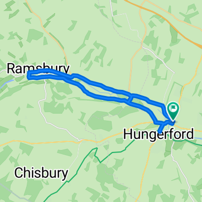
 Kennet/Ramsbury
- Distance
- 23.2 km
- Ascent
- 230 m
- Descent
- 232 m
- Location
- Hungerford, England, United Kingdom
 Slow ride in Hungerford
- Distance
- 19.1 km
- Ascent
- 140 m
- Descent
- 124 m
- Location
- Hungerford, England, United Kingdom
 Moderate route in Hungerford
- Distance
- 19.8 km
- Ascent
- 187 m
- Descent
- 190 m
- Location
- Hungerford, England, United Kingdom
 Bloody cold!!
- Distance
- 12.6 km
- Ascent
- 190 m
- Descent
- 179 m
- Location
- Hungerford, England, United Kingdom
 NCR4 Hungerford to Winsor
- Distance
- 76.4 km
- Ascent
- 171 m
- Descent
- 258 m
- Location
- Hungerford, England, United Kingdom
 Cotswold 7, Hungerford-Oxford
- Distance
- 52.7 km
- Ascent
- 302 m
- Descent
- 339 m
- Location
- Hungerford, England, United Kingdom
 Extensive Monday Course In Hungerford
- Distance
- 16.9 km
- Ascent
- 185 m
- Descent
- 184 m
- Location
- Hungerford, England, United Kingdom
 The Barrow Downs
- Distance
- 55.8 km
- Ascent
- 532 m
- Descent
- 511 m
- Location
- Hungerford, England, United Kingdom
Open it in the app