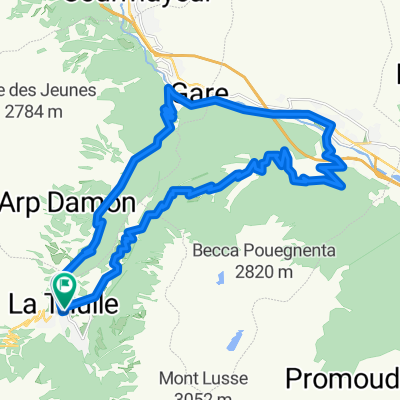
LTH-Les Suches-Le Foyer-LTH
- 23.4 km
- 857 m
- 847 m
- La Thuile, Aosta Valley, Italy
A cycling route starting in La Thuile, Aosta Valley, Italy.
Overview
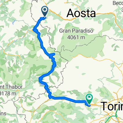
Col de l'Iseran, the highest pass reached by the Tour, starting from Italy (La Thuiel) and passing through the Little St. Bernard Pass, famous for allowing the passage of Hannibal's elephants and Napoleon's cannons. There and back, it totals 140 km of pure enjoyment in nature on mostly rideable climbs (5% on average).
created this 14 years ago
Continue with Bikemap
You would like to ride La Thuile - Col de l'Iseran e ritorno or customize it for your own trip? Here is what you can do with this Bikemap route:
Free trial for 3 days, or one-time payment. More about Bikemap Premium.
Discover more Premium features.
Get Bikemap PremiumFrom our community
Open it in the app