

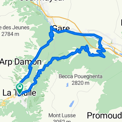
La Thuile - G.S.Bernardo e ritorno
A cycling route starting in La Thuile, Aosta Valley, Italy.
Overview
About this route
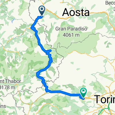
Descent to Aosta on a state road, wide and moderately busy (there is the highway), then we start climbing to reach it with rideable climbs (6% average) to the Passo del Gran San Bernardo at 2400 m above sea level; short rest and then back along the going route.
- -:--
- Duration
- 74 km
- Distance
- 1,918 m
- Ascent
- 902 m
- Descent
- ---
- Avg. speed
- ---
- Max. altitude
Route quality
Waytypes & surfaces along the route
Waytypes
Road
14.1 km
(19 %)
Quiet road
4.4 km
(6 %)
Surfaces
Paved
51.1 km
(69 %)
Unpaved
0.7 km
(1 %)
Asphalt
51.1 km
(69 %)
Ground
0.7 km
(1 %)
Undefined
22.2 km
(30 %)
Continue with Bikemap
Use, edit, or download this cycling route
You would like to ride La Thuile - G.S.Bernardo e ritorno or customize it for your own trip? Here is what you can do with this Bikemap route:
Free features
- Save this route as favorite or in collections
- Copy & plan your own version of this route
- Sync your route with Garmin or Wahoo
Premium features
Free trial for 3 days, or one-time payment. More about Bikemap Premium.
- Navigate this route on iOS & Android
- Export a GPX / KML file of this route
- Create your custom printout (try it for free)
- Download this route for offline navigation
Discover more Premium features.
Get Bikemap PremiumFrom our community
Other popular routes starting in La Thuile
 LTH-Les Suches-Le Foyer-LTH
- Distance
- 23.4 km
- Ascent
- 857 m
- Descent
- 847 m
- Location
- La Thuile, Aosta Valley, Italy
 2020-09-07 La Thuile - Avigliana
- Distance
- 164.5 km
- Ascent
- 4,747 m
- Descent
- 5,863 m
- Location
- La Thuile, Aosta Valley, Italy
 La Thuile - G.S.Bernardo e ritorno
- Distance
- 74 km
- Ascent
- 1,918 m
- Descent
- 902 m
- Location
- La Thuile, Aosta Valley, Italy
 LTH-Morgex-Colle San Carlo-LTH
- Distance
- 30.9 km
- Ascent
- 1,016 m
- Descent
- 1,016 m
- Location
- La Thuile, Aosta Valley, Italy
 La Thuille P.S. Bernardo
- Distance
- 13.5 km
- Ascent
- 804 m
- Descent
- 61 m
- Location
- La Thuile, Aosta Valley, Italy
 9 tappa traversata delle alpi
- Distance
- 136.1 km
- Ascent
- 2,274 m
- Descent
- 3,020 m
- Location
- La Thuile, Aosta Valley, Italy
 Loop around La Thuile ski station
- Distance
- 23.6 km
- Ascent
- 1,015 m
- Descent
- 998 m
- Location
- La Thuile, Aosta Valley, Italy
 La Thuile - Creta con ciaspole
- Distance
- 8.3 km
- Ascent
- 954 m
- Descent
- 959 m
- Location
- La Thuile, Aosta Valley, Italy
Open it in the app