

2011_1 Montpellier Vallon Pont d'Arc
A cycling route starting in Pérols, Occitanie, France.
Overview
About this route
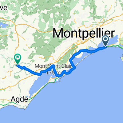
Day 1 of our tour from Montpellier to Bergamo.
The weather was cloudy, and in the late afternoon we got thoroughly washed (rained on).
It would be the only day Joachim told me I was too fast.
- -:--
- Duration
- 187.6 km
- Distance
- 1,519 m
- Ascent
- 1,401 m
- Descent
- ---
- Avg. speed
- ---
- Max. altitude
Route quality
Waytypes & surfaces along the route
Waytypes
Road
69.4 km
(37 %)
Quiet road
26.3 km
(14 %)
Surfaces
Paved
95.7 km
(51 %)
Unpaved
5.6 km
(3 %)
Asphalt
93.8 km
(50 %)
Gravel
3.8 km
(2 %)
Continue with Bikemap
Use, edit, or download this cycling route
You would like to ride 2011_1 Montpellier Vallon Pont d'Arc or customize it for your own trip? Here is what you can do with this Bikemap route:
Free features
- Save this route as favorite or in collections
- Copy & plan your own version of this route
- Split it into stages to create a multi-day tour
- Sync your route with Garmin or Wahoo
Premium features
Free trial for 3 days, or one-time payment. More about Bikemap Premium.
- Navigate this route on iOS & Android
- Export a GPX / KML file of this route
- Create your custom printout (try it for free)
- Download this route for offline navigation
Discover more Premium features.
Get Bikemap PremiumFrom our community
Other popular routes starting in Pérols
 2011_1 Montpellier Vallon Pont d'Arc
- Distance
- 187.6 km
- Ascent
- 1,519 m
- Descent
- 1,401 m
- Location
- Pérols, Occitanie, France
 Tour 2010 (a)
- Distance
- 96.2 km
- Ascent
- 299 m
- Descent
- 190 m
- Location
- Pérols, Occitanie, France
 De 3444–3840 Avenue Georges Frêche, Pérols à Avenue de Carnon, La Grande-Motte
- Distance
- 11 km
- Ascent
- 8 m
- Descent
- 9 m
- Location
- Pérols, Occitanie, France
 Itinéraire vers 437 Place Paul Valéry, La Grande-Motte
- Distance
- 13 km
- Ascent
- 8 m
- Descent
- 4 m
- Location
- Pérols, Occitanie, France
 De Chemin du Mas Michel 970, Mauguio à Rue de la Motte 29, Lansargues
- Distance
- 28.5 km
- Ascent
- 24 m
- Descent
- 29 m
- Location
- Pérols, Occitanie, France
 2023-06-06-Montpellier airport-Saint Roch-Pl. Auguste
- Distance
- 8.3 km
- Ascent
- 73 m
- Descent
- 45 m
- Location
- Pérols, Occitanie, France
 From Mauguio to Aumes
- Distance
- 70.7 km
- Ascent
- 324 m
- Descent
- 281 m
- Location
- Pérols, Occitanie, France
 2020 09 26 vélo
- Distance
- 46.5 km
- Ascent
- 173 m
- Descent
- 171 m
- Location
- Pérols, Occitanie, France
Open it in the app