

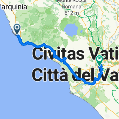
Civitavecchia-Tolfa
A cycling route starting in Civitavecchia, Lazio, Italy.
Overview
About this route
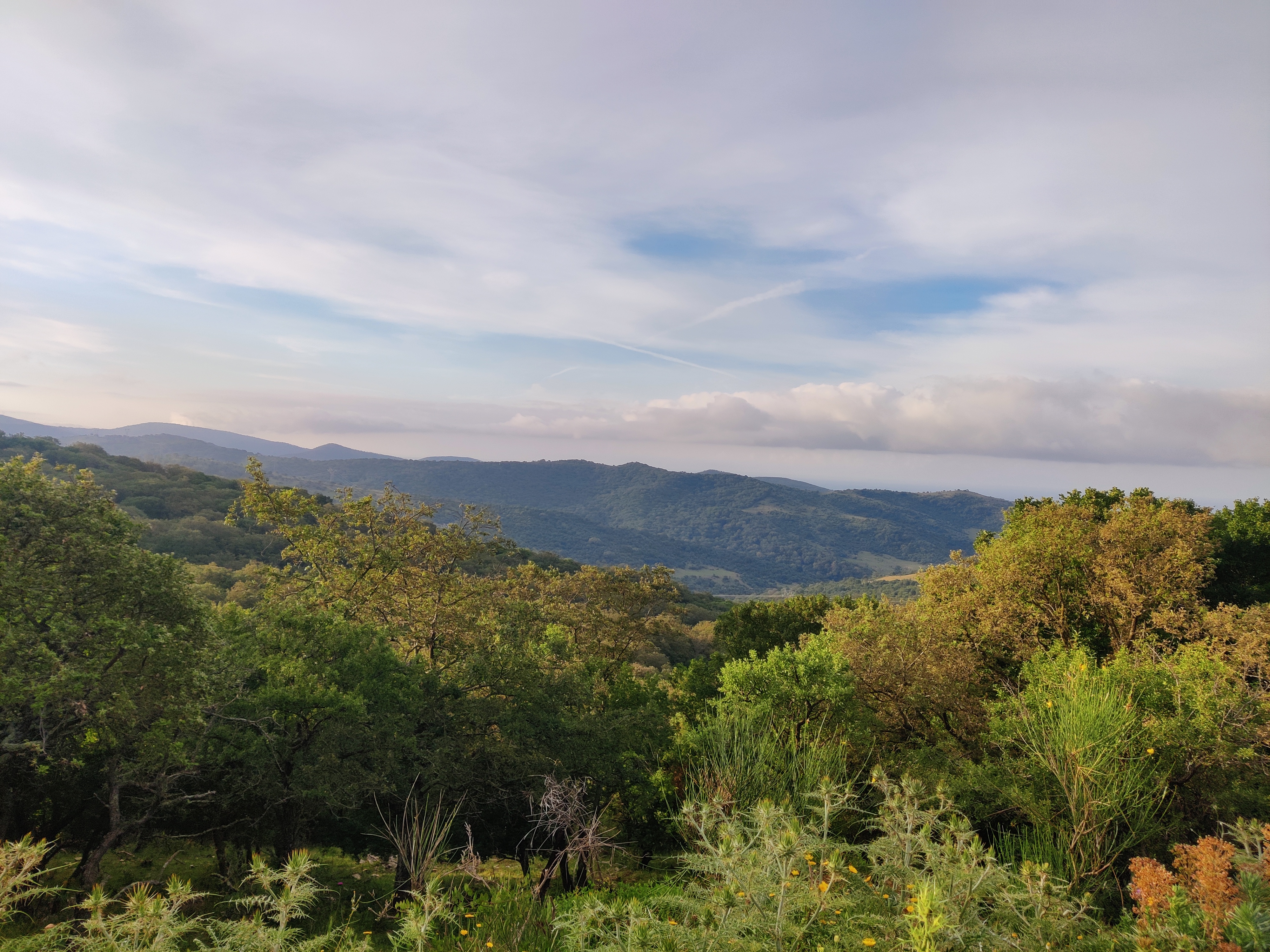
A very useful route for all tourists arriving in Civitavecchia by ship or staying in this important province of Lazio for more than 1 day who wish to discover the tourist realities within reach and accessible without great difficulties with the electric bike. The full route is 43 km long with a total elevation gain of 750 m, suitable for pedelecs with batteries of 500 Watt/h or more. The starting point is Forte Michelangelo, heading towards the Lighthouse of Civitavecchia, which is 150 m above sea level. From here, one can easily reach the Provincial Road Sassicari, which intersects at the 9th Km and at 330 m elevation with the Braccianese Claudia, which we follow until the 14th Km before heading towards La Bianca, just before reaching Tolfa at an altitude of 490 m. Along this 19 km stretch, it is possible to admire from above both the panoramas of the large cruise port and the farms, woods, and valleys that strongly characterize the agricultural and artisan activities of this area. Within Tolfa, one can easily visit the Rocca dei Frangipane, from which one dominates the view of the underlying valley. I also recommend a culinary stop at Sublime, suitable for both fast food and as a restaurant to taste local products such as ham, cheese, and bread from Tolfa. I also point out the Artisan Workshop of Lamberto and Valeria Bartolozzi for purchasing the famous and indestructible Catane made of cow leather (I've had one for over 40 years). For those with some experience in mountain biking, simple trails can also be made in the nearby beech forest of Allumiere on Monte Urbano or more challenging ones towards the Mignone river and the Colle dei Frati. On the way back to Civitavecchia, I also recommend taking a nice bath in the sulfurous thermal waters of the Bagni della Ficoncella. The ticket costs only 3,00 euros and is open all year round and every day of the week, with a large parking area for those arriving by car or camper. To conclude the tour, a ride along the wide seafront adjacent to the port will certainly be appreciated for some selfies before returning home.
- -:--
- Duration
- 18.9 km
- Distance
- 634 m
- Ascent
- 126 m
- Descent
- ---
- Avg. speed
- 550 m
- Max. altitude

Route photos


Route quality
Waytypes & surfaces along the route
Waytypes
Road
4.2 km
(22 %)
Quiet road
3 km
(16 %)
Surfaces
Paved
15.5 km
(82 %)
Asphalt
15.5 km
(82 %)
Undefined
3.4 km
(18 %)
Continue with Bikemap
Use, edit, or download this cycling route
You would like to ride Civitavecchia-Tolfa or customize it for your own trip? Here is what you can do with this Bikemap route:
Free features
- Save this route as favorite or in collections
- Copy & plan your own version of this route
- Sync your route with Garmin or Wahoo
Premium features
Free trial for 3 days, or one-time payment. More about Bikemap Premium.
- Navigate this route on iOS & Android
- Export a GPX / KML file of this route
- Create your custom printout (try it for free)
- Download this route for offline navigation
Discover more Premium features.
Get Bikemap PremiumFrom our community
Other popular routes starting in Civitavecchia
 Civitavecchia-Marina San Nicola
- Distance
- 42.8 km
- Ascent
- 105 m
- Descent
- 109 m
- Location
- Civitavecchia, Lazio, Italy
![05. [Italy] Civitavecchia - Ancona](https://media.bikemap.net/routes/1943473/staticmaps/in_14d6b50d-c2f2-44a7-bbdb-52de4575630c_400x400_bikemap-2021-3D-static.png) 05. [Italy] Civitavecchia - Ancona
05. [Italy] Civitavecchia - Ancona- Distance
- 1,119.8 km
- Ascent
- 1,436 m
- Descent
- 1,436 m
- Location
- Civitavecchia, Lazio, Italy
 Da Via Santa Barbara a Viale Palmiro Togliatti
- Distance
- 40.9 km
- Ascent
- 670 m
- Descent
- 719 m
- Location
- Civitavecchia, Lazio, Italy
 Civitavecchia - Rom
- Distance
- 107 km
- Ascent
- 546 m
- Descent
- 532 m
- Location
- Civitavecchia, Lazio, Italy
 tirrenica_ tratto civitavecchia-ladispoli
- Distance
- 35.5 km
- Ascent
- 0 m
- Descent
- 12 m
- Location
- Civitavecchia, Lazio, Italy
 Day 8 italia
- Distance
- 68.9 km
- Ascent
- 81 m
- Descent
- 99 m
- Location
- Civitavecchia, Lazio, Italy
 C2C - Civitavecchia to Pescara
- Distance
- 459.1 km
- Ascent
- 5,018 m
- Descent
- 5,010 m
- Location
- Civitavecchia, Lazio, Italy
 tirrenica:tratto civitavecchia da verificare
- Distance
- 3.5 km
- Ascent
- 30 m
- Descent
- 56 m
- Location
- Civitavecchia, Lazio, Italy
Open it in the app