

Celebration Square to Etobicoke Creek Trail to Brampton's Chinguacousy Park and Back
A cycling route starting in Mississauga, Ontario, Canada.
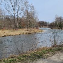
Overview
About this route
A mostly trailed and bike path route. It goes east to Etobicoke, going through parks around Burnhamthorpe Trail. Etobicoke Creek Trail is taken all the way up to Brampton. A trailess road leaves up to Chinguacousy Park. Trails lead back Home.
May be a little scary crossing the 407.
- 4 h 36 min
- Duration
- 65.6 km
- Distance
- 419 m
- Ascent
- 420 m
- Descent
- 14.3 km/h
- Avg. speed
- 234 m
- Max. altitude

Continue with Bikemap
Use, edit, or download this cycling route
You would like to ride Celebration Square to Etobicoke Creek Trail to Brampton's Chinguacousy Park and Back or customize it for your own trip? Here is what you can do with this Bikemap route:
Free features
- Save this route as favorite or in collections
- Copy & plan your own version of this route
- Sync your route with Garmin or Wahoo
Premium features
Free trial for 3 days, or one-time payment. More about Bikemap Premium.
- Navigate this route on iOS & Android
- Export a GPX / KML file of this route
- Create your custom printout (try it for free)
- Download this route for offline navigation
Discover more Premium features.
Get Bikemap PremiumFrom our community
Other popular routes starting in Mississauga
 Warmup Churchill to Brittania and back
- Distance
- 23.8 km
- Ascent
- 67 m
- Descent
- 64 m
- Location
- Mississauga, Ontario, Canada
 Etobicoke-Lakeshore-Miss Road
- Distance
- 40.5 km
- Ascent
- 133 m
- Descent
- 131 m
- Location
- Mississauga, Ontario, Canada
 Riverwood-SawmillValley-Culham Loop
- Distance
- 10.1 km
- Ascent
- 90 m
- Descent
- 93 m
- Location
- Mississauga, Ontario, Canada
 30k around the block
- Distance
- 29.1 km
- Ascent
- 124 m
- Descent
- 127 m
- Location
- Mississauga, Ontario, Canada
 bike tour through Mississauga Rd
- Distance
- 17.3 km
- Ascent
- 116 m
- Descent
- 116 m
- Location
- Mississauga, Ontario, Canada
 2689 Hollington Cres, Mississauga to 2652 Hollington Cres, Mississauga
- Distance
- 16.2 km
- Ascent
- 162 m
- Descent
- 161 m
- Location
- Mississauga, Ontario, Canada
 Erindale route...long
- Distance
- 29.6 km
- Ascent
- 296 m
- Descent
- 289 m
- Location
- Mississauga, Ontario, Canada
 MBRC-Campbellville via Hwy25 Speyside climb 52km
- Distance
- 52.1 km
- Ascent
- 235 m
- Descent
- 121 m
- Location
- Mississauga, Ontario, Canada
Open it in the app