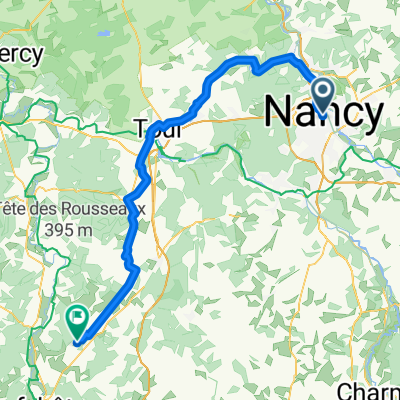
Nancy - Neufchâteau
- 69.9 km
- 544 m
- 425 m
- Nancy, Grand Est, France
A cycling route starting in Nancy, Grand Est, France.
Overview
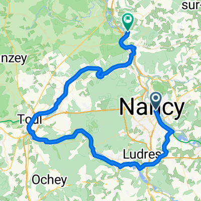
Start from Nancy towards Clairlieu and Maron, then take the bike path along the Moselle to Pierre-la-Treiche. Continue on the D121 towards Toul, then turn left onto the D904 towards Bicqueley. Turn right (West) after the church and follow a small road to Gye (beware of the D674 crossing which you cross straight), then on to Blénod-lès-Toul.
In Blénod, follow the street (still westbound) that crosses the village. In the center of the village, turn left and follow the D113 towards Vannes-le-Châtel. This is first a small mountain pass in Lorraine, then a quiet road through the forest, and finally a descent to Vannes-le-Châtel, known for its glass production. Join the D4 towards Uruffe, then (about 1-2 km behind Vannes) take the D32 to Pagny-la-Blanche-Côte.
At Pagny, turn right towards Champougny. The road first runs along the foot of a limestone hill where many orchids bloom in season. At Champougny (note the old chapel) you reach the Meuse valley and head north towards Sepvigny (chapel of Vieux-Astre) and continue to Chalaines (12th century fortification).
Turn right at Chalaines onto the D960 (towards Toul) which you leave after a few kilometers to Rigny-la-Salle, then St. Germain sur Meuse and finally Pagny sur Meuse (passing under the N4 expressway before entering the village). Continue on the D41 towards Trondes, then turn right on a pretty small road to Laneuveville-derrière-Foug, then Lucey, a winegrowers' village of the Côtes de Toul.
Leaving Lucey, cross the D908 towards Bouvron, then Francheville. In the center of Francheville, turn left and then join the D611 (beware of cars), before turning right at the next intersection towards Villey-Saint-Étienne. Turn right (South) following the D191 to the roundabout where you turn left and cross the Moselle. Leave the road to the right just after the bridge towards Fontenoy-sur-Moselle.
Turn right at the church (bike sign) and climb the slope out of the Moselle valley, then continue to Velaine-en-Haye (possibility to use the bike path). Cross the village to the traffic light at the intersection with the D400. Continue straight to enter and cross the Haye forest (paved road in very poor condition). You join the D92 coming from Maron to return to Clairlieu and Nancy.
created this 3 years ago


Route quality
Road
44.1 km
(37 %)
Quiet road
16.7 km
(14 %)
Paved
63.2 km
(53 %)
Asphalt
63.2 km
(53 %)
Undefined
56.1 km
(47 %)
Continue with Bikemap
You would like to ride Blénod - Pagny la Blanche Côte - Pagny sur Meuse or customize it for your own trip? Here is what you can do with this Bikemap route:
Free trial for 3 days, or one-time payment. More about Bikemap Premium.
Discover more Premium features.
Get Bikemap PremiumFrom our community
Open it in the app