

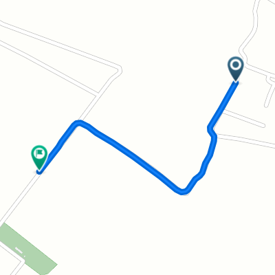
De tabio a cogua vereda el altico
A cycling route starting in Tabio, Cundinamarca, Colombia.
Overview
About this route
- 1 h 40 min
- Duration
- 24.6 km
- Distance
- 51 m
- Ascent
- 18 m
- Descent
- 14.7 km/h
- Avg. speed
- 2,619 m
- Max. altitude

Continue with Bikemap
Use, edit, or download this cycling route
You would like to ride De tabio a cogua vereda el altico or customize it for your own trip? Here is what you can do with this Bikemap route:
Free features
- Save this route as favorite or in collections
- Copy & plan your own version of this route
- Sync your route with Garmin or Wahoo
Premium features
Free trial for 3 days, or one-time payment. More about Bikemap Premium.
- Navigate this route on iOS & Android
- Export a GPX / KML file of this route
- Create your custom printout (try it for free)
- Download this route for offline navigation
Discover more Premium features.
Get Bikemap PremiumFrom our community
Other popular routes starting in Tabio
 Ruta tranquila en Colombia
- Distance
- 18.5 km
- Ascent
- 152 m
- Descent
- 155 m
- Location
- Tabio, Cundinamarca, Colombia
 Ruta moderada en Cota
- Distance
- 0.9 km
- Ascent
- 0 m
- Descent
- 0 m
- Location
- Tabio, Cundinamarca, Colombia
 cajica
- Distance
- 36.5 km
- Ascent
- 445 m
- Descent
- 522 m
- Location
- Tabio, Cundinamarca, Colombia
 De Variante a Zipaquira a Conexión a la Variante
- Distance
- 30 km
- Ascent
- 502 m
- Descent
- 512 m
- Location
- Tabio, Cundinamarca, Colombia
 De tabio a cogua vereda el altico
- Distance
- 24.6 km
- Ascent
- 51 m
- Descent
- 18 m
- Location
- Tabio, Cundinamarca, Colombia
 La lomita -cuchipanda
- Distance
- 9.8 km
- Ascent
- 206 m
- Descent
- 62 m
- Location
- Tabio, Cundinamarca, Colombia
 Ruta a Vía sin nombre, El Tejar
- Distance
- 18.9 km
- Ascent
- 11 m
- Descent
- 256 m
- Location
- Tabio, Cundinamarca, Colombia
 De Tenjo-Tabio a Calle 17b 7-45, Mosquera
- Distance
- 31.6 km
- Ascent
- 107 m
- Descent
- 147 m
- Location
- Tabio, Cundinamarca, Colombia
Open it in the app