

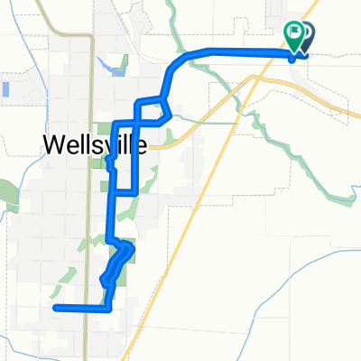
748 E Main St, Wellsville do 748 E Main St, Wellsville
A cycling route starting in Wellsville, Utah, United States of America.
Overview
About this route
- 2 h 33 min
- Duration
- 32.5 km
- Distance
- 266 m
- Ascent
- 271 m
- Descent
- 12.8 km/h
- Avg. speed
- 1,522 m
- Max. altitude

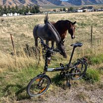
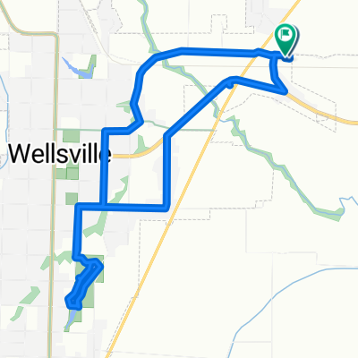
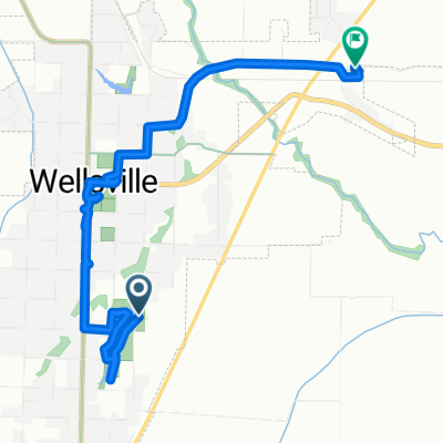
Route photos


Route quality
Waytypes & surfaces along the route
Waytypes
Quiet road
21.5 km
(66 %)
Busy road
6.3 km
(19 %)
Surfaces
Paved
28.7 km
(88 %)
Asphalt
28.6 km
(88 %)
Concrete
0.2 km
(<1 %)
Undefined
3.8 km
(12 %)
Continue with Bikemap
Use, edit, or download this cycling route
You would like to ride 748 E Main St, Wellsville do 748 E Main St, Wellsville or customize it for your own trip? Here is what you can do with this Bikemap route:
Free features
- Save this route as favorite or in collections
- Copy & plan your own version of this route
- Sync your route with Garmin or Wahoo
Premium features
Free trial for 3 days, or one-time payment. More about Bikemap Premium.
- Navigate this route on iOS & Android
- Export a GPX / KML file of this route
- Create your custom printout (try it for free)
- Download this route for offline navigation
Discover more Premium features.
Get Bikemap PremiumFrom our community
Other popular routes starting in Wellsville
 748 E Main St, Wellsville do 748 E Main St, Wellsville
- Distance
- 32.5 km
- Ascent
- 266 m
- Descent
- 271 m
- Location
- Wellsville, Utah, United States of America
 390 N 900 E, Wellsville to 390 N 900 E, Wellsville
- Distance
- 10.7 km
- Ascent
- 62 m
- Descent
- 74 m
- Location
- Wellsville, Utah, United States of America
 390 N 900 E, Wellsville to 390 N 900 E, Wellsville
- Distance
- 9.3 km
- Ascent
- 52 m
- Descent
- 50 m
- Location
- Wellsville, Utah, United States of America
 437–699 S 200 E, Wellsville to 390 N 900 E, Wellsville
- Distance
- 6.9 km
- Ascent
- 33 m
- Descent
- 32 m
- Location
- Wellsville, Utah, United States of America
Open it in the app