

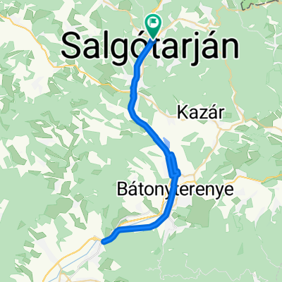
Palócföld
A cycling route starting in Salgótarján, Nógrád megye, Hungary.
Overview
About this route
- -:--
- Duration
- 90.8 km
- Distance
- 718 m
- Ascent
- 823 m
- Descent
- ---
- Avg. speed
- 422 m
- Max. altitude

Route quality
Waytypes & surfaces along the route
Waytypes
Road
19.1 km
(21 %)
Cycleway
15.4 km
(17 %)
Surfaces
Paved
59.9 km
(66 %)
Unpaved
8.2 km
(9 %)
Asphalt
59.9 km
(66 %)
Gravel
4.5 km
(5 %)
Continue with Bikemap
Use, edit, or download this cycling route
You would like to ride Palócföld or customize it for your own trip? Here is what you can do with this Bikemap route:
Free features
- Save this route as favorite or in collections
- Copy & plan your own version of this route
- Split it into stages to create a multi-day tour
- Sync your route with Garmin or Wahoo
Premium features
Free trial for 3 days, or one-time payment. More about Bikemap Premium.
- Navigate this route on iOS & Android
- Export a GPX / KML file of this route
- Create your custom printout (try it for free)
- Download this route for offline navigation
Discover more Premium features.
Get Bikemap PremiumFrom our community
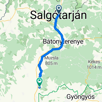
Other popular routes starting in Salgótarján
 Zagyvapálfalva - Hatvan
- Distance
- 100.6 km
- Ascent
- 1,030 m
- Descent
- 1,136 m
- Location
- Salgótarján, Nógrád megye, Hungary
 From Salgótarján to Hatvan
- Distance
- 64.2 km
- Ascent
- 193 m
- Descent
- 317 m
- Location
- Salgótarján, Nógrád megye, Hungary
 Úttörők út - Úttörők út
- Distance
- 45.5 km
- Ascent
- 153 m
- Descent
- 193 m
- Location
- Salgótarján, Nógrád megye, Hungary
 Bajcsy-Zsilinszky út 57, Salgótarján - Bajcsy-Zsilinszky út 57, Salgótarján
- Distance
- 12 km
- Ascent
- 73 m
- Descent
- 123 m
- Location
- Salgótarján, Nógrád megye, Hungary
 bhucigogho
- Distance
- 43 km
- Ascent
- 88 m
- Descent
- 195 m
- Location
- Salgótarján, Nógrád megye, Hungary
 megintfejlettcucc
- Distance
- 129.9 km
- Ascent
- 878 m
- Descent
- 1,048 m
- Location
- Salgótarján, Nógrád megye, Hungary
 tarjan kupa
- Distance
- 26.6 km
- Ascent
- 257 m
- Descent
- 257 m
- Location
- Salgótarján, Nógrád megye, Hungary
 Medves-Tarna-vidék
- Distance
- 75.5 km
- Ascent
- 554 m
- Descent
- 556 m
- Location
- Salgótarján, Nógrád megye, Hungary
Open it in the app