

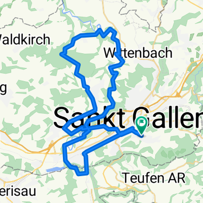
SG- Gäbris-Hohe Buche- Waldegg
A cycling route starting in St. Gallen, Canton of St. Gallen, Switzerland.
Overview
About this route
- -:--
- Duration
- 30 km
- Distance
- 825 m
- Ascent
- 825 m
- Descent
- ---
- Avg. speed
- ---
- Max. altitude
Route quality
Waytypes & surfaces along the route
Waytypes
Track
10.1 km
(34 %)
Quiet road
7.7 km
(26 %)
Surfaces
Paved
13.2 km
(44 %)
Unpaved
11.5 km
(38 %)
Asphalt
12.9 km
(43 %)
Gravel
8.1 km
(27 %)
Continue with Bikemap
Use, edit, or download this cycling route
You would like to ride SG- Gäbris-Hohe Buche- Waldegg or customize it for your own trip? Here is what you can do with this Bikemap route:
Free features
- Save this route as favorite or in collections
- Copy & plan your own version of this route
- Sync your route with Garmin or Wahoo
Premium features
Free trial for 3 days, or one-time payment. More about Bikemap Premium.
- Navigate this route on iOS & Android
- Export a GPX / KML file of this route
- Create your custom printout (try it for free)
- Download this route for offline navigation
Discover more Premium features.
Get Bikemap PremiumFrom our community
Other popular routes starting in St. Gallen
 St. Gallen Heiden
- Distance
- 32.7 km
- Ascent
- 812 m
- Descent
- 811 m
- Location
- St. Gallen, Canton of St. Gallen, Switzerland
 Sitterstrandweg
- Distance
- 50.6 km
- Ascent
- 1,234 m
- Descent
- 1,260 m
- Location
- St. Gallen, Canton of St. Gallen, Switzerland
 Rundfahrt St. Gallen - Gübsensee - Hundwil - Stein - Riethüsli - St. Gallen CLONED FROM ROUTE 170310
- Distance
- 25.1 km
- Ascent
- 478 m
- Descent
- 476 m
- Location
- St. Gallen, Canton of St. Gallen, Switzerland
 Rundfahrt Rosenberg-Erlenholz-Tannenberg-Ätschberg-Hafnersberg-Abtwil-St.Gallen
- Distance
- 27 km
- Ascent
- 775 m
- Descent
- 827 m
- Location
- St. Gallen, Canton of St. Gallen, Switzerland
 13.03.11 Sitter Tour
- Distance
- 39.8 km
- Ascent
- 650 m
- Descent
- 650 m
- Location
- St. Gallen, Canton of St. Gallen, Switzerland
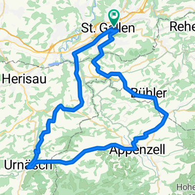 appenzellerrundfahrt
- Distance
- 48.9 km
- Ascent
- 833 m
- Descent
- 768 m
- Location
- St. Gallen, Canton of St. Gallen, Switzerland
 St. Gallen-St. Anton-Trogen-St. Gallen
- Distance
- 29.7 km
- Ascent
- 828 m
- Descent
- 828 m
- Location
- St. Gallen, Canton of St. Gallen, Switzerland
 SG- Gäbris-Hohe Buche- Waldegg
- Distance
- 30 km
- Ascent
- 825 m
- Descent
- 825 m
- Location
- St. Gallen, Canton of St. Gallen, Switzerland
Open it in the app