

Ighiu-Telna-V.Telnei-Salase-Telna-Ighiu
A cycling route starting in Ighiu, Alba County, Romania.
Overview
About this route
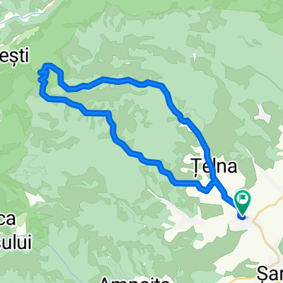
Drive uphill on Telna Valley (~825 m - 15km)
On the top follow a single track on the left following your gps device (on first 500-1000 m the road is not easy to find)
You will be rewarded by a beautifull scenery (view of Alba-Iulia) 1 of the nicest in the region !
Follow downhill the road between the hills and peasant houses untill you arrive in Telna.
I recommend to drive in this direction as the reverse one is pretty steep but not impossible (to some of you)
- -:--
- Duration
- 28.5 km
- Distance
- 927 m
- Ascent
- 924 m
- Descent
- ---
- Avg. speed
- ---
- Max. altitude

Route quality
Waytypes & surfaces along the route
Waytypes
Track
22.8 km
(80 %)
Road
5.1 km
(18 %)
Quiet road
0.6 km
(2 %)
Surfaces
Paved
5.1 km
(18 %)
Unpaved
0.3 km
(1 %)
Asphalt
5.1 km
(18 %)
Gravel
0.3 km
(1 %)
Undefined
23.1 km
(81 %)
Continue with Bikemap
Use, edit, or download this cycling route
You would like to ride Ighiu-Telna-V.Telnei-Salase-Telna-Ighiu or customize it for your own trip? Here is what you can do with this Bikemap route:
Free features
- Save this route as favorite or in collections
- Copy & plan your own version of this route
- Sync your route with Garmin or Wahoo
Premium features
Free trial for 3 days, or one-time payment. More about Bikemap Premium.
- Navigate this route on iOS & Android
- Export a GPX / KML file of this route
- Create your custom printout (try it for free)
- Download this route for offline navigation
Discover more Premium features.
Get Bikemap PremiumFrom our community
Other popular routes starting in Ighiu
 Ighiu - Telna - DC 70 - Iezerul Ighiel - Ighiel -Ighiu
- Distance
- 33.8 km
- Ascent
- 1,005 m
- Descent
- 1,002 m
- Location
- Ighiu, Alba County, Romania
 Ighiu-Iezer-Intregalde-Cheia-Bradesti-Rimetea
- Distance
- 71.8 km
- Ascent
- 1,926 m
- Descent
- 1,662 m
- Location
- Ighiu, Alba County, Romania
 Oualor-Craivii
- Distance
- 33.7 km
- Ascent
- 1,000 m
- Descent
- 993 m
- Location
- Ighiu, Alba County, Romania
 Ighiel - Negrileasa - Caprei - Cheile Ampoitei
- Distance
- 74.3 km
- Ascent
- 1,954 m
- Descent
- 1,956 m
- Location
- Ighiu, Alba County, Romania
 Ighiel - Negrileasa - Caprei
- Distance
- 73.7 km
- Ascent
- 1,739 m
- Descent
- 1,736 m
- Location
- Ighiu, Alba County, Romania
 Ighiu - Telna - DC 70 - Iezerul Ighiel - Piatra Grohotisului - Ighiel -Ighiu
- Distance
- 35.6 km
- Ascent
- 1,309 m
- Descent
- 1,310 m
- Location
- Ighiu, Alba County, Romania
 Ighiu-Telna-V.Telnei-Salase-Telna-Ighiu
- Distance
- 28.5 km
- Ascent
- 927 m
- Descent
- 924 m
- Location
- Ighiu, Alba County, Romania
 In varful iezerului
- Distance
- 33.2 km
- Ascent
- 989 m
- Descent
- 988 m
- Location
- Ighiu, Alba County, Romania
Open it in the app