
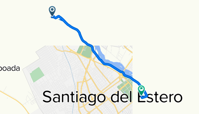
De Aeropuerto El Cadillal, Santiago del Estero a Avenida Alsina 13, Santiago del Estero
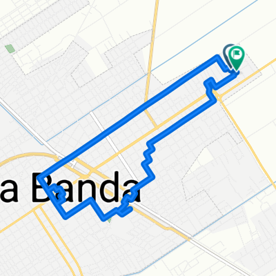
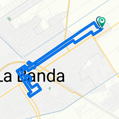
A cycling route starting in La Banda, Santiago del Estero Province, Argentina.
Overview
About this route
- 27 min
- Duration
- 7.9 km
- Distance
- 36 m
- Ascent
- 36 m
- Descent
- 17.5 km/h
- Avg. speed
- 197 m
- Max. altitude

Route photos


Continue with Bikemap
Use, edit, or download this cycling route
You would like to ride De Aeropuerto El Cadillal, Santiago del Estero a Avenida Alsina 13, Santiago del Estero or customize it for your own trip? Here is what you can do with this Bikemap route:
Free features
- Save this route as favorite or in collections
- Copy & plan your own version of this route
- Sync your route with Garmin or Wahoo
Premium features
Free trial for 3 days, or one-time payment. More about Bikemap Premium.
- Navigate this route on iOS & Android
- Export a GPX / KML file of this route
- Create your custom printout (try it for free)
- Download this route for offline navigation
Discover more Premium features.
Get Bikemap PremiumFrom our community
Other popular routes starting in La Banda
 Ruta 1
- Distance
- 11 km
- Ascent
- 3 m
- Descent
- 3 m
- Location
- La Banda, Santiago del Estero Province, Argentina
 Ruta relajada en Santiago del Estero
- Distance
- 8.7 km
- Ascent
- 69 m
- Descent
- 63 m
- Location
- La Banda, Santiago del Estero Province, Argentina
 Lengthy ride through Los Arias
- Distance
- 37.5 km
- Ascent
- 9 m
- Descent
- 10 m
- Location
- La Banda, Santiago del Estero Province, Argentina
 Ruta 2
- Distance
- 12.5 km
- Ascent
- 6 m
- Descent
- 6 m
- Location
- La Banda, Santiago del Estero Province, Argentina
 De Aeropuerto El Cadillal, Santiago del Estero a Avenida Alsina 13, Santiago del Estero
- Distance
- 7.9 km
- Ascent
- 36 m
- Descent
- 36 m
- Location
- La Banda, Santiago del Estero Province, Argentina
 Recovered Route
- Distance
- 32.7 km
- Ascent
- 59 m
- Descent
- 59 m
- Location
- La Banda, Santiago del Estero Province, Argentina
 Ruta a Aeropuerto Mal Paso, Santiago del Estero
- Distance
- 23.9 km
- Ascent
- 58 m
- Descent
- 51 m
- Location
- La Banda, Santiago del Estero Province, Argentina
 Ruta desde Ruta Provincial 51, La Banda
- Distance
- 8.6 km
- Ascent
- 13 m
- Descent
- 9 m
- Location
- La Banda, Santiago del Estero Province, Argentina
Open it in the app