

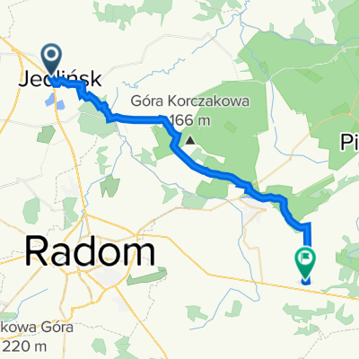
Bierwce 44C, Jedlińsk do Bierwce 44B, Jedlińsk
A cycling route starting in Gmina Jedlińsk, Masovian Voivodeship, Poland.
Overview
About this route
- 1 h 26 min
- Duration
- 11.8 km
- Distance
- 123 m
- Ascent
- 122 m
- Descent
- 8.3 km/h
- Avg. speed
- 163 m
- Max. altitude
Route quality
Waytypes & surfaces along the route
Waytypes
Quiet road
8.9 km
(75 %)
Pedestrian area
0.8 km
(7 %)
Surfaces
Paved
4.4 km
(37 %)
Unpaved
0.6 km
(5 %)
Asphalt
4.4 km
(37 %)
Unpaved (undefined)
0.6 km
(5 %)
Undefined
6.9 km
(58 %)
Continue with Bikemap
Use, edit, or download this cycling route
You would like to ride Bierwce 44C, Jedlińsk do Bierwce 44B, Jedlińsk or customize it for your own trip? Here is what you can do with this Bikemap route:
Free features
- Save this route as favorite or in collections
- Copy & plan your own version of this route
- Sync your route with Garmin or Wahoo
Premium features
Free trial for 3 days, or one-time payment. More about Bikemap Premium.
- Navigate this route on iOS & Android
- Export a GPX / KML file of this route
- Create your custom printout (try it for free)
- Download this route for offline navigation
Discover more Premium features.
Get Bikemap PremiumFrom our community
Other popular routes starting in Gmina Jedlińsk
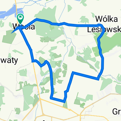 Kalinowa 7, Wsola do Kalinowa 7, Wsola
- Distance
- 29.3 km
- Ascent
- 174 m
- Descent
- 155 m
- Location
- Gmina Jedlińsk, Masovian Voivodeship, Poland
 Kalinowa 7, Wsola do Kalinowa 7, Wsola
- Distance
- 22 km
- Ascent
- 83 m
- Descent
- 97 m
- Location
- Gmina Jedlińsk, Masovian Voivodeship, Poland
 powrót z Jedlińska
- Distance
- 29.4 km
- Ascent
- 116 m
- Descent
- 75 m
- Location
- Gmina Jedlińsk, Masovian Voivodeship, Poland
 Mijanka Radomia
- Distance
- 13.7 km
- Ascent
- 65 m
- Descent
- 55 m
- Location
- Gmina Jedlińsk, Masovian Voivodeship, Poland
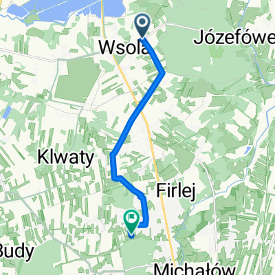 Leśna 30, Wsola do Klwatecka 75M, Radom
- Distance
- 7.1 km
- Ascent
- 23 m
- Descent
- 8 m
- Location
- Gmina Jedlińsk, Masovian Voivodeship, Poland
 Rynek 8, Jedlińsk do Polna 5, Jedlińsk
- Distance
- 11.3 km
- Ascent
- 45 m
- Descent
- 84 m
- Location
- Gmina Jedlińsk, Masovian Voivodeship, Poland
 wsola (las,wielo,rdm,firlej,(sklep), s7,)
- Distance
- 13.5 km
- Ascent
- 94 m
- Descent
- 97 m
- Location
- Gmina Jedlińsk, Masovian Voivodeship, Poland
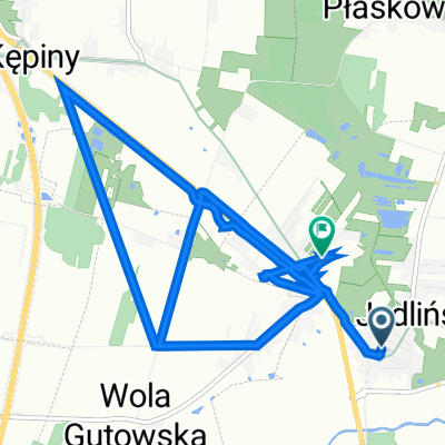
 trasa
trasa- Distance
- 127.3 km
- Ascent
- 134 m
- Descent
- 190 m
- Location
- Gmina Jedlińsk, Masovian Voivodeship, Poland
Open it in the app