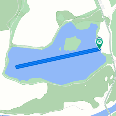
Srbsko - Rumburk
A cycling route starting in Žďár, Central Bohemia, Czechia.
Overview
About this route
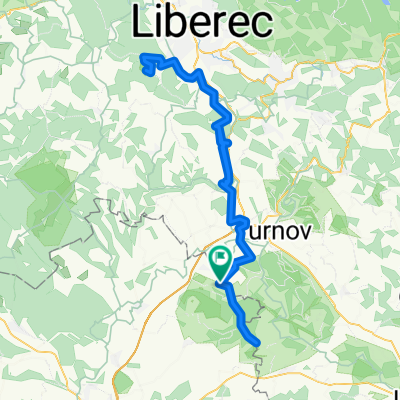
The route from the village of Srbské in the Bohemian Paradise through Mnichovo Hradiště, the former military area of Ralsko, Mimoň, Dolní Světlou to Rumburk. The route is rather flat, except for the crossing of the ridge of the Lusatian Mountains between Dolní Světlou and Waltersdorf (576 m above sea level).
- -:--
- Duration
- 87.6 km
- Distance
- 561 m
- Ascent
- 438 m
- Descent
- ---
- Avg. speed
- ---
- Max. altitude
Route quality
Waytypes & surfaces along the route
Waytypes
Road
37.7 km
(43 %)
Quiet road
14.9 km
(17 %)
Surfaces
Paved
43.8 km
(50 %)
Unpaved
7.9 km
(9 %)
Asphalt
38.6 km
(44 %)
Paved (undefined)
4.4 km
(5 %)
Continue with Bikemap
Use, edit, or download this cycling route
You would like to ride Srbsko - Rumburk or customize it for your own trip? Here is what you can do with this Bikemap route:
Free features
- Save this route as favorite or in collections
- Copy & plan your own version of this route
- Split it into stages to create a multi-day tour
- Sync your route with Garmin or Wahoo
Premium features
Free trial for 3 days, or one-time payment. More about Bikemap Premium.
- Navigate this route on iOS & Android
- Export a GPX / KML file of this route
- Create your custom printout (try it for free)
- Download this route for offline navigation
Discover more Premium features.
Get Bikemap PremiumFrom our community
Other popular routes starting in Žďár
srbsko, kost drhleny branžež srbsko- Distance
- 22.3 km
- Ascent
- 250 m
- Descent
- 252 m
- Location
- Žďár, Central Bohemia, Czechia
Cyklotrasy 042 - Český ráj- Distance
- 43.9 km
- Ascent
- 873 m
- Descent
- 874 m
- Location
- Žďár, Central Bohemia, Czechia
Ještěd CLONED FROM ROUTE 150609- Distance
- 100.6 km
- Ascent
- 1,541 m
- Descent
- 1,502 m
- Location
- Žďár, Central Bohemia, Czechia
2025 Himmelfahrt 04 D- Distance
- 59.6 km
- Ascent
- 1,060 m
- Descent
- 999 m
- Location
- Žďár, Central Bohemia, Czechia
Kozákov, Ještěd- Gravel/road- Distance
- 100.2 km
- Ascent
- 1,382 m
- Descent
- 1,379 m
- Location
- Žďár, Central Bohemia, Czechia
Svijanský Újezd-Trosky-Vyskeř-Svijanský Újezd- Distance
- 49.8 km
- Ascent
- 427 m
- Descent
- 433 m
- Location
- Žďár, Central Bohemia, Czechia
lehká trasa Branžež- Distance
- 31.2 km
- Ascent
- 192 m
- Descent
- 168 m
- Location
- Žďár, Central Bohemia, Czechia
Vyskeř - Příhrazy Kost Sobotka - Vyskeř- Distance
- 41.8 km
- Ascent
- 529 m
- Descent
- 545 m
- Location
- Žďár, Central Bohemia, Czechia
Open it in the app

