

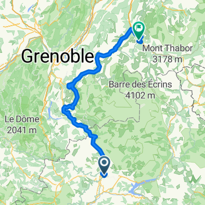
*13-V. Gap - Briançon (156,5 Km)
A cycling route starting in Gap, Provence-Alpes-Côte d'Azur Region, France.
Overview
About this route
- -:--
- Duration
- 156.5 km
- Distance
- 3,826 m
- Ascent
- 3,293 m
- Descent
- ---
- Avg. speed
- 1,386 m
- Max. altitude
Route quality
Waytypes & surfaces along the route
Waytypes
Road
37.6 km
(24 %)
Quiet road
11 km
(7 %)
Surfaces
Paved
70.4 km
(45 %)
Asphalt
70.4 km
(45 %)
Undefined
86.1 km
(55 %)
Route highlights
Points of interest along the route
Point of interest after 31.3 km
Col du BUISSONNET (HC) Km 31,3 · 1.380 m
Point of interest after 52.9 km
Col des GARCINETS (2) Km 52,1 · 1.185 m
Point of interest after 79.4 km
Col LEBRAUT (HC) Km 79 · 1.110 m
Point of interest after 108.6 km
Sprint EMBRUN Km 106,3
Point of interest after 146.3 km
Côte de QUEYRIÈRES (3) Km 146 · 1.232 m
Continue with Bikemap
Use, edit, or download this cycling route
You would like to ride *13-V. Gap - Briançon (156,5 Km) or customize it for your own trip? Here is what you can do with this Bikemap route:
Free features
- Save this route as favorite or in collections
- Copy & plan your own version of this route
- Split it into stages to create a multi-day tour
- Sync your route with Garmin or Wahoo
Premium features
Free trial for 3 days, or one-time payment. More about Bikemap Premium.
- Navigate this route on iOS & Android
- Export a GPX / KML file of this route
- Create your custom printout (try it for free)
- Download this route for offline navigation
Discover more Premium features.
Get Bikemap PremiumFrom our community
Other popular routes starting in Gap
 Tour de France 2015 - Stage 18
- Distance
- 190.3 km
- Ascent
- 3,252 m
- Descent
- 3,447 m
- Location
- Gap, Provence-Alpes-Côte d'Azur Region, France
 Francia Alpok 08
- Distance
- 98.6 km
- Ascent
- 1,637 m
- Descent
- 1,864 m
- Location
- Gap, Provence-Alpes-Côte d'Azur Region, France
 De Ä£@Ú? à Ä£@Ú?
- Distance
- 97.9 km
- Ascent
- 1,970 m
- Descent
- 1,970 m
- Location
- Gap, Provence-Alpes-Côte d'Azur Region, France
 montcolombis
- Distance
- 89.8 km
- Ascent
- 2,278 m
- Descent
- 2,276 m
- Location
- Gap, Provence-Alpes-Côte d'Azur Region, France
 Gap - L'Hermitage 46k
- Distance
- 47.1 km
- Ascent
- 782 m
- Descent
- 785 m
- Location
- Gap, Provence-Alpes-Côte d'Azur Region, France
 HeroÏca by GravelbyBarnel Gap Cuneo
- Distance
- 319.8 km
- Ascent
- 6,477 m
- Descent
- 6,693 m
- Location
- Gap, Provence-Alpes-Côte d'Azur Region, France
 Tour sympa au départ de Gap
- Distance
- 82 km
- Ascent
- 1,340 m
- Descent
- 1,332 m
- Location
- Gap, Provence-Alpes-Côte d'Azur Region, France
 COL BAYARD (por Gap)
- Distance
- 8.9 km
- Ascent
- 509 m
- Descent
- 0 m
- Location
- Gap, Provence-Alpes-Côte d'Azur Region, France
Open it in the app