

E-MTB Gsth Aumühle - Speckalm Süd
A cycling route starting in Bad Kreuzen, Upper Austria, Austria.
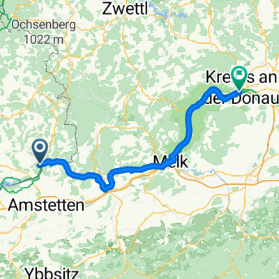
Overview
About this route
- 26 min
- Duration
- 7 km
- Distance
- 277 m
- Ascent
- 307 m
- Descent
- 15.8 km/h
- Avg. speed
- 521 m
- Max. altitude
Route quality
Waytypes & surfaces along the route
Waytypes
Track
3.6 km
(52 %)
Quiet road
2.6 km
(37 %)
Surfaces
Paved
1.5 km
(21 %)
Unpaved
0.6 km
(9 %)
Paved (undefined)
1.5 km
(21 %)
Ground
0.3 km
(5 %)
Continue with Bikemap
Use, edit, or download this cycling route
You would like to ride E-MTB Gsth Aumühle - Speckalm Süd or customize it for your own trip? Here is what you can do with this Bikemap route:
Free features
- Save this route as favorite or in collections
- Copy & plan your own version of this route
- Sync your route with Garmin or Wahoo
Premium features
Free trial for 3 days, or one-time payment. More about Bikemap Premium.
- Navigate this route on iOS & Android
- Export a GPX / KML file of this route
- Create your custom printout (try it for free)
- Download this route for offline navigation
Discover more Premium features.
Get Bikemap PremiumFrom our community
Other popular routes starting in Bad Kreuzen
 Track 3
- Distance
- 106.5 km
- Ascent
- 864 m
- Descent
- 1,128 m
- Location
- Bad Kreuzen, Upper Austria, Austria
 Donau_Etappe_04_Grein-Melk
- Distance
- 47.9 km
- Ascent
- 155 m
- Descent
- 179 m
- Location
- Bad Kreuzen, Upper Austria, Austria
 Donau_Etappe_04_Grein-Melk
- Distance
- 51.2 km
- Ascent
- 181 m
- Descent
- 203 m
- Location
- Bad Kreuzen, Upper Austria, Austria
 Grein 3 Flüsse Rund Wallsee Ardagger Grein
- Distance
- 74.2 km
- Ascent
- 45 m
- Descent
- 41 m
- Location
- Bad Kreuzen, Upper Austria, Austria
 Panholz 17 nach Panholz 17
- Distance
- 35.9 km
- Ascent
- 718 m
- Descent
- 648 m
- Location
- Bad Kreuzen, Upper Austria, Austria
 Grein - Krems
- Distance
- 87.1 km
- Ascent
- 541 m
- Descent
- 573 m
- Location
- Bad Kreuzen, Upper Austria, Austria
 Eurospar in Grein an der Donau
- Distance
- 6.5 km
- Ascent
- 25 m
- Descent
- 217 m
- Location
- Bad Kreuzen, Upper Austria, Austria
 Donauradweg - 6 day (Grein - Klam - Grein)
- Distance
- 22.3 km
- Ascent
- 285 m
- Descent
- 285 m
- Location
- Bad Kreuzen, Upper Austria, Austria
Open it in the app