517 W Lois Way, Louisville to 517 W Lois Way, Louisville
A cycling route starting in Louisville, Colorado, United States of America.
Overview
About this route
- 1 h 42 min
- Duration
- 22.9 km
- Distance
- 211 m
- Ascent
- 227 m
- Descent
- 13.4 km/h
- Avg. speed
- 1,747 m
- Avg. speed
Route quality
Waytypes & surfaces along the route
Waytypes
Path
12.4 km
(54 %)
Cycleway
5.5 km
(24 %)
Surfaces
Paved
8 km
(35 %)
Unpaved
13.5 km
(59 %)
Ground
6.8 km
(30 %)
Concrete
4.6 km
(20 %)
Continue with Bikemap
Use, edit, or download this cycling route
You would like to ride 517 W Lois Way, Louisville to 517 W Lois Way, Louisville or customize it for your own trip? Here is what you can do with this Bikemap route:
Free features
- Save this route as favorite or in collections
- Copy & plan your own version of this route
- Sync your route with Garmin or Wahoo
Premium features
Free trial for 3 days, or one-time payment. More about Bikemap Premium.
- Navigate this route on iOS & Android
- Export a GPX / KML file of this route
- Create your custom printout (try it for free)
- Download this route for offline navigation
Discover more Premium features.
Get Bikemap PremiumFrom our community
Other popular routes starting in Louisville
- Going to Work
- Distance
- 35.3 km
- Ascent
- 207 m
- Descent
- 209 m
- Location
- Louisville, Colorado, United States of America
- Louisville to Peak to Peak Hwy
- Distance
- 58.2 km
- Ascent
- 1,367 m
- Descent
- 181 m
- Location
- Louisville, Colorado, United States of America
- 892 W South Boulder Rd, Louisville to 1920 Vista Dr, Boulder
- Distance
- 15.2 km
- Ascent
- 86 m
- Descent
- 153 m
- Location
- Louisville, Colorado, United States of America
- 2nd mile
- Distance
- 32.5 km
- Ascent
- 2,998 m
- Descent
- 3,027 m
- Location
- Louisville, Colorado, United States of America
- Valmont Loop
- Distance
- 34.9 km
- Ascent
- 195 m
- Descent
- 195 m
- Location
- Louisville, Colorado, United States of America
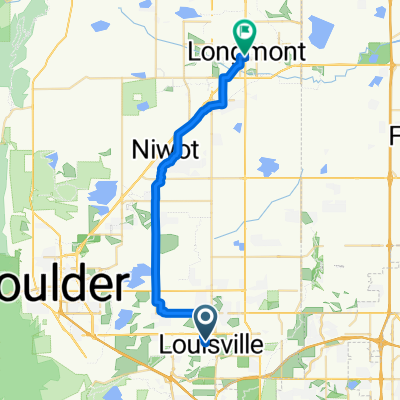
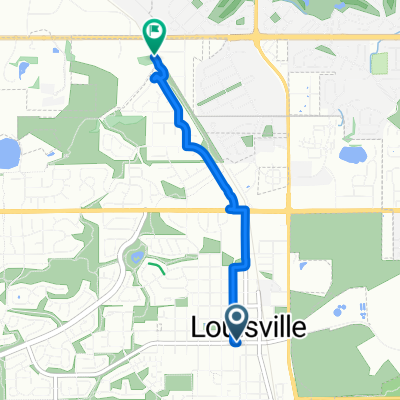
- to the lookout and mall
- Distance
- 18.9 km
- Ascent
- 1,066 m
- Descent
- 1,225 m
- Location
- Louisville, Colorado, United States of America
- 263 S Jefferson Ave, Louisville to 640 Main St, Louisville
- Distance
- 25.1 km
- Ascent
- 129 m
- Descent
- 134 m
- Location
- Louisville, Colorado, United States of America
- Louisville- reservoir and left
- Distance
- 13.1 km
- Ascent
- 112 m
- Descent
- 112 m
- Location
- Louisville, Colorado, United States of America
Open it in the app