

Bad Essen 15
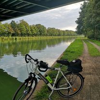
A cycling route starting in Bad Essen, Lower Saxony, Germany.
Overview
About this route
- -:--
- Duration
- 14.7 km
- Distance
- 330 m
- Ascent
- 269 m
- Descent
- ---
- Avg. speed
- 183 m
- Max. altitude

Route quality
Waytypes & surfaces along the route
Waytypes
Track
10.6 km
(72 %)
Path
2.7 km
(18 %)
Surfaces
Paved
1.3 km
(9 %)
Unpaved
10.2 km
(69 %)
Gravel
8.1 km
(55 %)
Asphalt
1.2 km
(8 %)
Continue with Bikemap
Use, edit, or download this cycling route
You would like to ride Bad Essen 15 or customize it for your own trip? Here is what you can do with this Bikemap route:
Free features
- Save this route as favorite or in collections
- Copy & plan your own version of this route
- Sync your route with Garmin or Wahoo
Premium features
Free trial for 3 days, or one-time payment. More about Bikemap Premium.
- Navigate this route on iOS & Android
- Export a GPX / KML file of this route
- Create your custom printout (try it for free)
- Download this route for offline navigation
Discover more Premium features.
Get Bikemap PremiumFrom our community
Other popular routes starting in Bad Essen
 Bad Essen - Waldtour
- Distance
- 17.5 km
- Ascent
- 205 m
- Descent
- 226 m
- Location
- Bad Essen, Lower Saxony, Germany
 D008-RundUmBadEssen-43km
- Distance
- 42.9 km
- Ascent
- 269 m
- Descent
- 265 m
- Location
- Bad Essen, Lower Saxony, Germany
 Entlang des Wiehengebirges
- Distance
- 49.1 km
- Ascent
- 45 m
- Descent
- 48 m
- Location
- Bad Essen, Lower Saxony, Germany
 Bad Essen - Meller Berge
- Distance
- 45.5 km
- Ascent
- 603 m
- Descent
- 603 m
- Location
- Bad Essen, Lower Saxony, Germany
 Auf den Spuren der Familie von Bussche (So, 07.07.2024)
- Distance
- 23 km
- Ascent
- 32 m
- Descent
- 31 m
- Location
- Bad Essen, Lower Saxony, Germany
 Denkmalsweg 1, Bad Essen nach Wehrendorfer Bergstraße 4, Bad Essen
- Distance
- 32.5 km
- Ascent
- 372 m
- Descent
- 322 m
- Location
- Bad Essen, Lower Saxony, Germany
 Senfdamm 28, Bad Essen nach Steinbrink 25, Bad Essen
- Distance
- 1.8 km
- Ascent
- 5 m
- Descent
- 8 m
- Location
- Bad Essen, Lower Saxony, Germany
 Schlösser Tour - Bad Essen
- Distance
- 15.1 km
- Ascent
- 84 m
- Descent
- 74 m
- Location
- Bad Essen, Lower Saxony, Germany
Open it in the app