

tschaufen Cilly
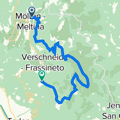
A cycling route starting in Mölten, Trentino-Alto Adige, Italy.
Overview
About this route
Von Mölten über schermoos Gschnofer zum Tschaufen
- -:--
- Duration
- 15 km
- Distance
- 581 m
- Ascent
- 408 m
- Descent
- ---
- Avg. speed
- 1,466 m
- Max. altitude

Route quality
Waytypes & surfaces along the route
Waytypes
Track
9.3 km
(62 %)
Quiet road
2.8 km
(19 %)
Surfaces
Paved
1.2 km
(8 %)
Unpaved
7.9 km
(52 %)
Gravel
4.7 km
(31 %)
Ground
1.3 km
(9 %)
Continue with Bikemap
Use, edit, or download this cycling route
You would like to ride tschaufen Cilly or customize it for your own trip? Here is what you can do with this Bikemap route:
Free features
- Save this route as favorite or in collections
- Copy & plan your own version of this route
- Sync your route with Garmin or Wahoo
Premium features
Free trial for 3 days, or one-time payment. More about Bikemap Premium.
- Navigate this route on iOS & Android
- Export a GPX / KML file of this route
- Create your custom printout (try it for free)
- Download this route for offline navigation
Discover more Premium features.
Get Bikemap PremiumFrom our community
Other popular routes starting in Mölten
 Mölten Hafling
- Distance
- 69.7 km
- Ascent
- 1,756 m
- Descent
- 2,509 m
- Location
- Mölten, Trentino-Alto Adige, Italy
 Mölten besser Gschnover Tschaufen
- Distance
- 14.3 km
- Ascent
- 471 m
- Descent
- 335 m
- Location
- Mölten, Trentino-Alto Adige, Italy
 Valas-Terlan-St.Felix-Fondo-Bolzano-Valas
- Distance
- 108.1 km
- Ascent
- 2,726 m
- Descent
- 2,728 m
- Location
- Mölten, Trentino-Alto Adige, Italy
 Via Vernag 33, Meltina nach Möltnerstraße 54, Mölten
- Distance
- 9.5 km
- Ascent
- 531 m
- Descent
- 564 m
- Location
- Mölten, Trentino-Alto Adige, Italy
 tschaufen Cilly
- Distance
- 15 km
- Ascent
- 581 m
- Descent
- 408 m
- Location
- Mölten, Trentino-Alto Adige, Italy
 möldner Kaser
- Distance
- 5.3 km
- Ascent
- 495 m
- Descent
- 100 m
- Location
- Mölten, Trentino-Alto Adige, Italy
 Schlaneid Vöraner Joch
- Distance
- 14.9 km
- Ascent
- 869 m
- Descent
- 161 m
- Location
- Mölten, Trentino-Alto Adige, Italy
 schlaneid1
- Distance
- 8.7 km
- Ascent
- 239 m
- Descent
- 245 m
- Location
- Mölten, Trentino-Alto Adige, Italy
Open it in the app