


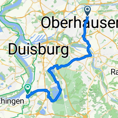
Halden von Oberhausen - Hochfeld
- 28.1 km
- 79 m
- 84 m
- Oberhausen, North Rhine-Westphalia, Germany
A cycling route starting in Oberhausen, North Rhine-Westphalia, Germany.
Overview
Weierstraße, HOAG Trasse, Stadion Oberhausen, Olga-Park, alte Bahntrasse durch Osterfeld richtung Bottrop, Golfplatz Osterfeld, alte Bahntrasse zur Halde, Kreuzweg auf die Halde, auf der rückseite nach unten, richtung Grafmühle, am Rotbach entlang über die Mountainbikestrecke zur Wiskybude, weiter am Rotbach entlang richtung Hiesfeld, um den Rotbachsee herum am Reitverein Hiesfeld vorbei, durch den Stadtwald Oberhausen, HOAG Trasse, Weierstraße
created this 16 years ago
Route highlights
Alte Steinmauer auf der linken Seite. Danach den nächsten Weg links abbiegen.
Continue with Bikemap
You would like to ride wxf-02 or customize it for your own trip? Here is what you can do with this Bikemap route:
Free trial for 3 days, or one-time payment. More about Bikemap Premium.
Discover more Premium features.
Get Bikemap PremiumFrom our community
EDGE EXPLORE2®
mit dem Rad von Oberhausen am Rhein-Herne-Kanal entlangOpen it in the app


