O 10.00 pod fontanną
- 124.3 km
- 499 m
- 491 m
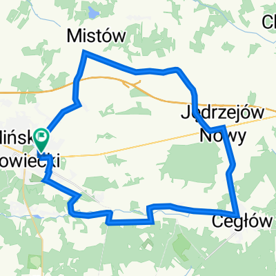
- Mińsk Mazowiecki, Masovian Voivodeship, Poland
A cycling route starting in Mińsk Mazowiecki, Masovian Voivodeship, Poland.
Overview
Optymalna
created this 3 years ago
Route quality
Quiet road
18.1 km
(47 %)
Road
10 km
(26 %)
Paved
20 km
(52 %)
Unpaved
10 km
(26 %)
Asphalt
19.3 km
(50 %)
Gravel
4.6 km
(12 %)
Continue with Bikemap
You would like to ride Trasa Znana i Nieznana Ziemia Minska or customize it for your own trip? Here is what you can do with this Bikemap route:
Free trial for 3 days, or one-time payment. More about Bikemap Premium.
Discover more Premium features.
Get Bikemap PremiumFrom our community
Open it in the app