

Overview
About this route
Die zweite und höchste Überquerung unserer Tour steht an. Aus Innsbruck raus geht es direkt auf das steilste Stück, das gleichzeitig eine stark befahrene Landstraße ist, einer der schlimmsten Abschnitte der Tour. Sobald es aber oben wieder (verhältnismäßig) flacher wird, geht es auf kleinen Wegen und ruhigeren Straßen weiter und es macht wieder Spaß. Die letzten Kilometer vor dem Brenner werden nochmal schweißtreibend und verkehrslastig.
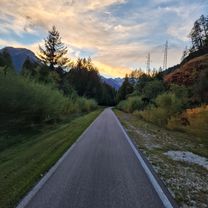
Sobald man aber die Grenze überschreitet, verwandelt sich der Weg in den Traum jedes Radreisenden. Nicht nur geht es jetzt stetig bergab - hier ist der Weg perfekt ausgebaut und beschildert und verläuft auf einer stillgelegten Bahntrasse.
- 10 h 2 min
- Duration
- 71.5 km
- Distance
- 1,136 m
- Ascent
- 770 m
- Descent
- 7.1 km/h
- Avg. speed
- 1,380 m
- Max. altitude

Part of
7 stages
Route photos


Route quality
Waytypes & surfaces along the route
Waytypes
Cycleway
17.9 km
(25 %)
Quiet road
12.2 km
(17 %)
Surfaces
Paved
54.3 km
(76 %)
Unpaved
1.4 km
(2 %)
Asphalt
53.6 km
(75 %)
Wood
0.7 km
(1 %)
Continue with Bikemap
Use, edit, or download this cycling route
You would like to ride Über den Brenner or customize it for your own trip? Here is what you can do with this Bikemap route:
Free features
- Save this route as favorite or in collections
- Copy & plan your own version of this route
- Sync your route with Garmin or Wahoo
Premium features
Free trial for 3 days, or one-time payment. More about Bikemap Premium.
- Navigate this route on iOS & Android
- Export a GPX / KML file of this route
- Create your custom printout (try it for free)
- Download this route for offline navigation
Discover more Premium features.
Get Bikemap PremiumFrom our community
Other popular routes starting in Innsbruck
 Nockspitz-Überschreitung
- Distance
- 54 km
- Ascent
- 2,398 m
- Descent
- 2,385 m
- Location
- Innsbruck, Tyrol, Austria
 Innsbruck II
- Distance
- 15.7 km
- Ascent
- 1,386 m
- Descent
- 0 m
- Location
- Innsbruck, Tyrol, Austria
 Innsbruck / Zirl / Magdeburger Hüttn / Kranebitten
- Distance
- 52.2 km
- Ascent
- 1,200 m
- Descent
- 1,199 m
- Location
- Innsbruck, Tyrol, Austria
- Über den Brenner
- Distance
- 71.5 km
- Ascent
- 1,136 m
- Descent
- 770 m
- Location
- Innsbruck, Tyrol, Austria
 Am Roßsprung 1, Innsbruck nach Am Roßsprung 1, Innsbruck
- Distance
- 40 km
- Ascent
- 622 m
- Descent
- 674 m
- Location
- Innsbruck, Tyrol, Austria
 Stockerhof-Runde
- Distance
- 26.4 km
- Ascent
- 874 m
- Descent
- 875 m
- Location
- Innsbruck, Tyrol, Austria
 IBK - Maria Waldrast - IBK
- Distance
- 62.1 km
- Ascent
- 1,628 m
- Descent
- 1,626 m
- Location
- Innsbruck, Tyrol, Austria
 Lange Ausfahrt durch Innsbruck
- Distance
- 46.3 km
- Ascent
- 68 m
- Descent
- 67 m
- Location
- Innsbruck, Tyrol, Austria
Open it in the app