

C2C3 DAY1彰化-潭雅神-后豐-大甲
A cycling route starting in Chang-hua, Taiwan, Taiwan.
Overview
About this route
童子軍彰二團承辦第三次C2C活動第一天路線
- -:--
- Duration
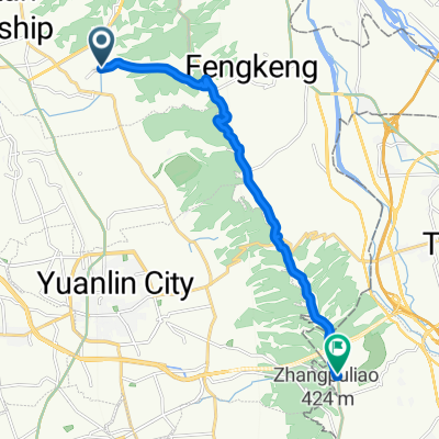
- 72.4 km
- Distance
- 393 m
- Ascent
- 354 m
- Descent
- ---
- Avg. speed
- ---
- Max. altitude
Route highlights
Points of interest along the route
Point of interest after 18.3 km
臺灣高鐵台中站
Point of interest after 47.2 km
合作國小
Point of interest after 72.1 km
大甲鎮瀾宮
Continue with Bikemap
Use, edit, or download this cycling route
You would like to ride C2C3 DAY1彰化-潭雅神-后豐-大甲 or customize it for your own trip? Here is what you can do with this Bikemap route:
Free features
- Save this route as favorite or in collections
- Copy & plan your own version of this route
- Sync your route with Garmin or Wahoo
Premium features
Free trial for 3 days, or one-time payment. More about Bikemap Premium.
- Navigate this route on iOS & Android
- Export a GPX / KML file of this route
- Create your custom printout (try it for free)
- Download this route for offline navigation
Discover more Premium features.
Get Bikemap PremiumFrom our community
Other popular routes starting in Chang-hua
 東外環-三分橋-員林大碗公
- Distance
- 42.9 km
- Ascent
- 368 m
- Descent
- 371 m
- Location
- Chang-hua, Taiwan, Taiwan
 縣道136+台21
- Distance
- 108.3 km
- Ascent
- 1,368 m
- Descent
- 1,368 m
- Location
- Chang-hua, Taiwan, Taiwan
 別毛山林道
別毛山林道- Distance
- 126.7 km
- Ascent
- 1,311 m
- Descent
- 1,311 m
- Location
- Chang-hua, Taiwan, Taiwan
 聖安路
聖安路- Distance
- 18.6 km
- Ascent
- 204 m
- Descent
- 126 m
- Location
- Chang-hua, Taiwan, Taiwan
 花壇三芬橋到鳳山寺
- Distance
- 14.2 km
- Ascent
- 429 m
- Descent
- 75 m
- Location
- Chang-hua, Taiwan, Taiwan
 C2C3 DAY1彰化-潭雅神-后豐-大甲
- Distance
- 72.4 km
- Ascent
- 393 m
- Descent
- 354 m
- Location
- Chang-hua, Taiwan, Taiwan
 中彰轉-139 路段 車少空氣好
- Distance
- 35 km
- Ascent
- 452 m
- Descent
- 425 m
- Location
- Chang-hua, Taiwan, Taiwan
 2011_09_25 第二屆 環化賽
- Distance
- 107.8 km
- Ascent
- 458 m
- Descent
- 460 m
- Location
- Chang-hua, Taiwan, Taiwan
Open it in the app