

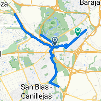
Calle de Albadalejo, 24, Madrid a Calle de Albadalejo, 22, Madrid
A cycling route starting in San Blas-Canillejas, Madrid, Spain.
Overview
About this route
- 3 h 26 min
- Duration
- 60.5 km
- Distance
- 439 m
- Ascent
- 447 m
- Descent
- 17.6 km/h
- Avg. speed
- 733 m
- Max. altitude

Route quality
Waytypes & surfaces along the route
Waytypes
Cycleway
46.6 km
(77 %)
Quiet road
4.2 km
(7 %)
Surfaces
Paved
38.7 km
(64 %)
Unpaved
0.6 km
(1 %)
Asphalt
20.6 km
(34 %)
Concrete
13.3 km
(22 %)
Continue with Bikemap
Use, edit, or download this cycling route
You would like to ride Calle de Albadalejo, 24, Madrid a Calle de Albadalejo, 22, Madrid or customize it for your own trip? Here is what you can do with this Bikemap route:
Free features
- Save this route as favorite or in collections
- Copy & plan your own version of this route
- Sync your route with Garmin or Wahoo
Premium features
Free trial for 3 days, or one-time payment. More about Bikemap Premium.
- Navigate this route on iOS & Android
- Export a GPX / KML file of this route
- Create your custom printout (try it for free)
- Download this route for offline navigation
Discover more Premium features.
Get Bikemap PremiumFrom our community
Other popular routes starting in San Blas-Canillejas
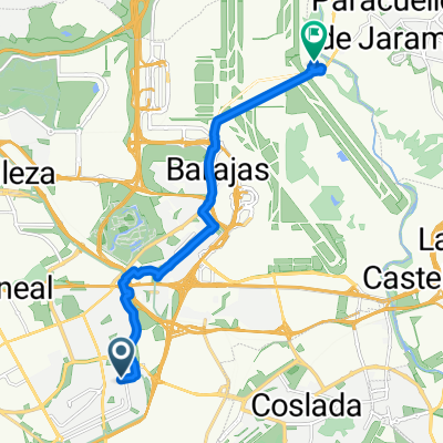
 Aeropuerto
- Distance
- 43.7 km
- Ascent
- 204 m
- Descent
- 204 m
- Location
- San Blas-Canillejas, Madrid, Spain
 anillo ciclista madrid. este norte oeste
- Distance
- 26.8 km
- Ascent
- 191 m
- Descent
- 235 m
- Location
- San Blas-Canillejas, Madrid, Spain
 Paseo con Daniel
- Distance
- 21.7 km
- Ascent
- 123 m
- Descent
- 124 m
- Location
- San Blas-Canillejas, Madrid, Spain
 la paseada 4
- Distance
- 21.8 km
- Ascent
- 159 m
- Descent
- 169 m
- Location
- San Blas-Canillejas, Madrid, Spain
 Caja Mágica, camino Uclés, Rivas, Vicalvaro
- Distance
- 52.4 km
- Ascent
- 220 m
- Descent
- 224 m
- Location
- San Blas-Canillejas, Madrid, Spain
 De Calle de Julia García Boután a Calle Miguel de Cervantes
- Distance
- 12.9 km
- Ascent
- 49 m
- Descent
- 190 m
- Location
- San Blas-Canillejas, Madrid, Spain
 Tour de Madrid
- Distance
- 62.9 km
- Ascent
- 1,765 m
- Descent
- 1,759 m
- Location
- San Blas-Canillejas, Madrid, Spain
 Paracaellos de Jara
- Distance
- 39.1 km
- Ascent
- 304 m
- Descent
- 304 m
- Location
- San Blas-Canillejas, Madrid, Spain
Open it in the app