

Feldalm-Hochalm
A cycling route starting in Kössen, Tyrol, Austria.
Overview
About this route
Beautiful alpine tour, one can gradually increase the difficulty and tackle the last steep ascent with pleasure. The reward is the beautiful panoramic view. It is advisable to take on the extra challenge with the climb to Hochalm, with an additional approximately 100 m of elevation gain.
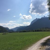
The mountains are within reach.
- -:--
- Duration
- 34.5 km
- Distance
- 946 m
- Ascent
- 946 m
- Descent
- ---
- Avg. speed
- ---
- Max. altitude
Route quality
Waytypes & surfaces along the route
Waytypes
Track
19.3 km
(56 %)
Quiet road
11.4 km
(33 %)
Surfaces
Paved
12.8 km
(37 %)
Unpaved
20 km
(58 %)
Gravel
14.5 km
(42 %)
Asphalt
12.8 km
(37 %)
Continue with Bikemap
Use, edit, or download this cycling route
You would like to ride Feldalm-Hochalm or customize it for your own trip? Here is what you can do with this Bikemap route:
Free features
- Save this route as favorite or in collections
- Copy & plan your own version of this route
- Sync your route with Garmin or Wahoo
Premium features
Free trial for 3 days, or one-time payment. More about Bikemap Premium.
- Navigate this route on iOS & Android
- Export a GPX / KML file of this route
- Create your custom printout (try it for free)
- Download this route for offline navigation
Discover more Premium features.
Get Bikemap PremiumFrom our community
Other popular routes starting in Kössen
 Kössen - Bayrisch-Zell - Kufstein - Kössen
- Distance
- 103.7 km
- Ascent
- 2,079 m
- Descent
- 2,223 m
- Location
- Kössen, Tyrol, Austria
 Zwei auf einen Schlag
- Distance
- 47.6 km
- Ascent
- 1,432 m
- Descent
- 1,432 m
- Location
- Kössen, Tyrol, Austria
 Kössen - St. Johann Rundkurs
- Distance
- 43 km
- Ascent
- 771 m
- Descent
- 814 m
- Location
- Kössen, Tyrol, Austria
 Kössen Cafe Zacherl
- Distance
- 49.6 km
- Ascent
- 735 m
- Descent
- 733 m
- Location
- Kössen, Tyrol, Austria
 Rund um den Unterberg - Kössen
- Distance
- 57.2 km
- Ascent
- 605 m
- Descent
- 570 m
- Location
- Kössen, Tyrol, Austria
 Bayr. Runde
- Distance
- 60.1 km
- Ascent
- 428 m
- Descent
- 428 m
- Location
- Kössen, Tyrol, Austria
 Erl - Aschau - Kössen
- Distance
- 80.4 km
- Ascent
- 456 m
- Descent
- 456 m
- Location
- Kössen, Tyrol, Austria
 Kössen, Weißbach , Walchsee, Kössen-Runde
- Distance
- 38.3 km
- Ascent
- 960 m
- Descent
- 962 m
- Location
- Kössen, Tyrol, Austria
Open it in the app