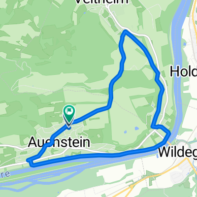
Hallwilersee-Baldeggersee-Sempachersee
A cycling route starting in Rupperswil, Canton of Aargau, Switzerland.
Overview
About this route
- -:--
- Duration
- 91.3 km
- Distance
- 486 m
- Ascent
- 486 m
- Descent
- ---
- Avg. speed
- ---
- Avg. speed
Route quality
Waytypes & surfaces along the route
Waytypes
Busy road
34.8 km
(38 %)
Quiet road
21.1 km
(23 %)
Surfaces
Paved
38.9 km
(43 %)
Unpaved
0.5 km
(<1 %)
Asphalt
36 km
(39 %)
Paved (undefined)
2.5 km
(3 %)
Continue with Bikemap
Use, edit, or download this cycling route
You would like to ride Hallwilersee-Baldeggersee-Sempachersee or customize it for your own trip? Here is what you can do with this Bikemap route:
Free features
- Save this route as favorite or in collections
- Copy & plan your own version of this route
- Sync your route with Garmin or Wahoo
Premium features
Free trial for 3 days, or one-time payment. More about Bikemap Premium.
- Navigate this route on iOS & Android
- Export a GPX / KML file of this route
- Create your custom printout (try it for free)
- Download this route for offline navigation
Discover more Premium features.
Get Bikemap PremiumFrom our community
Other popular routes starting in Rupperswil
- Hallwilersee rundfahrt
- Distance
- 58.3 km
- Ascent
- 316 m
- Descent
- 316 m
- Location
- Rupperswil, Canton of Aargau, Switzerland
- frühlingserwachen
- Distance
- 39.1 km
- Ascent
- 195 m
- Descent
- 195 m
- Location
- Rupperswil, Canton of Aargau, Switzerland
- Buchmatt_Küttigen
- Distance
- 28.6 km
- Ascent
- 585 m
- Descent
- 585 m
- Location
- Rupperswil, Canton of Aargau, Switzerland
- 20170717_094213.gpx
- Distance
- 39.4 km
- Ascent
- 441 m
- Descent
- 442 m
- Location
- Rupperswil, Canton of Aargau, Switzerland
- MTB Gisliflue-Staffelegg-Linnerberg-Villnachern
- Distance
- 38.3 km
- Ascent
- 772 m
- Descent
- 772 m
- Location
- Rupperswil, Canton of Aargau, Switzerland
- Aarau-Baselbiet-Runde
- Distance
- 103.5 km
- Ascent
- 2,529 m
- Descent
- 2,480 m
- Location
- Rupperswil, Canton of Aargau, Switzerland
- Gugen, Geiss-, Wasser- und Gisliflue
- Distance
- 49.2 km
- Ascent
- 1,229 m
- Descent
- 1,237 m
- Location
- Rupperswil, Canton of Aargau, Switzerland
- R'rswil - Saalhöhe - Benkerjoch - Staffelegg - H'bank
- Distance
- 48.6 km
- Ascent
- 950 m
- Descent
- 971 m
- Location
- Rupperswil, Canton of Aargau, Switzerland
Open it in the app