

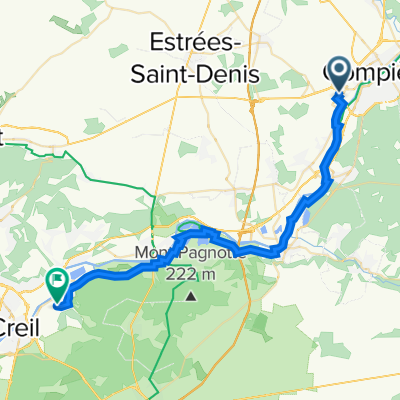
102 Avenue Jean Moulin, Jaux à 80 Rue de Noyon, Bailly
A cycling route starting in Jaux, Hauts-de-France, France.
Overview
About this route
- 1 h 54 min
- Duration
- 22.7 km
- Distance
- 244 m
- Ascent
- 261 m
- Descent
- 11.9 km/h
- Avg. speed
- 58 m
- Max. altitude
Route quality
Waytypes & surfaces along the route
Waytypes
Track
4.1 km
(18 %)
Quiet road
3.6 km
(16 %)
Surfaces
Paved
15.9 km
(70 %)
Unpaved
1.1 km
(5 %)
Asphalt
15.9 km
(70 %)
Loose gravel
1.1 km
(5 %)
Undefined
5.7 km
(25 %)
Continue with Bikemap
Use, edit, or download this cycling route
You would like to ride 102 Avenue Jean Moulin, Jaux à 80 Rue de Noyon, Bailly or customize it for your own trip? Here is what you can do with this Bikemap route:
Free features
- Save this route as favorite or in collections
- Copy & plan your own version of this route
- Sync your route with Garmin or Wahoo
Premium features
Free trial for 3 days, or one-time payment. More about Bikemap Premium.
- Navigate this route on iOS & Android
- Export a GPX / KML file of this route
- Create your custom printout (try it for free)
- Download this route for offline navigation
Discover more Premium features.
Get Bikemap PremiumFrom our community
Other popular routes starting in Jaux
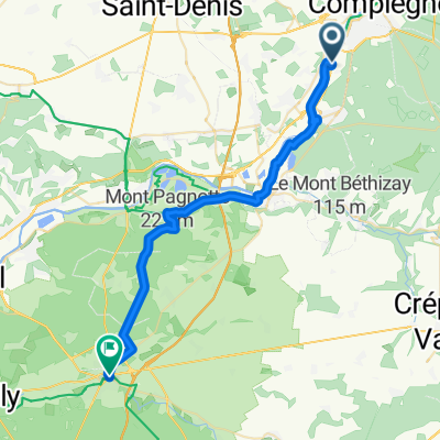
 Compiegne to Paris
- Distance
- 94.3 km
- Ascent
- 379 m
- Descent
- 385 m
- Location
- Jaux, Hauts-de-France, France
 De 4 Rue Ferdinand de Lesseps, Compiègne à D630, Fontaine-Notre-Dame
- Distance
- 107.1 km
- Ascent
- 625 m
- Descent
- 602 m
- Location
- Jaux, Hauts-de-France, France
 102 Avenue Jean Moulin, Jaux naar 12 Rue de l'Égalité, Verneuil-en-Halatte
- Distance
- 34.7 km
- Ascent
- 116 m
- Descent
- 126 m
- Location
- Jaux, Hauts-de-France, France
 Etappe 8 Compiègne - Paris
- Distance
- 75.5 km
- Ascent
- 272 m
- Descent
- 251 m
- Location
- Jaux, Hauts-de-France, France
 Jaux Cycling
- Distance
- 31.9 km
- Ascent
- 175 m
- Descent
- 138 m
- Location
- Jaux, Hauts-de-France, France
 Paris to Valenciennes
- Distance
- 235.7 km
- Ascent
- 461 m
- Descent
- 457 m
- Location
- Jaux, Hauts-de-France, France
 PANAME AMSTERDAM Etape 2: Compiègne / Cambrai
- Distance
- 119.3 km
- Ascent
- 322 m
- Descent
- 295 m
- Location
- Jaux, Hauts-de-France, France
 TRV 2013 dag 7
- Distance
- 92.7 km
- Ascent
- 293 m
- Descent
- 279 m
- Location
- Jaux, Hauts-de-France, France
Open it in the app